Tepetzintla geodata
Tepetzintla (Puebla) is a seat of a second-order administrative division; located in Mexico in America/Mexico_City (GMT-6) time zone. With population of 1,170 people, there are 7425 cities with bigger population in this country. Compared to other cities in Mexico, 56.4% of cities are located further ↓South; 65.5% of cities are located further ←West and 57.9% of cities have lower elevation than Tepetzintla. Note1


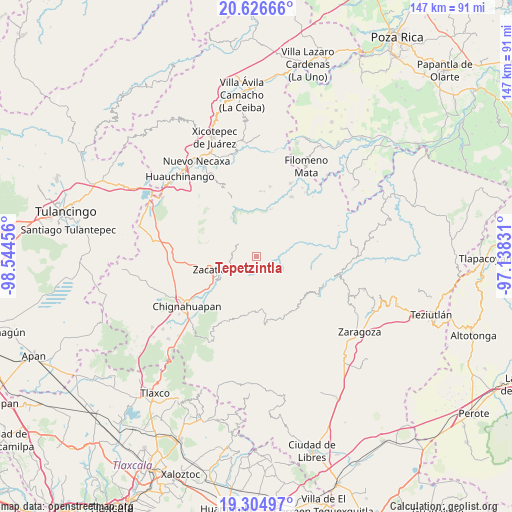
Tepetzintla GPS coordinates[2]
19° 58' 1.92" North, 97° 50' 29.148" West
| Map corner | latitude | longitude |
|---|---|---|
| Upper-left | 20.62666°, | -98.54456° |
| Center: | 19.9672°, | -97.84143° |
| Lower-right: | 19.30497°, | -97.13831° |
| Map W x H: | 147×147 km | = 91.3×91.3mi |
| max Lat: | 32.7° ⇑43.6% North |
| Tepetzintla: | 19.9672° |
| min Lat: | ⇓56.4% South 14.53588° |
| min Long | Tepetzintla | max Long |
| -117.105° | -97.84143° | -86.73105° |
| W 65.5%⇐ | ⇒34.5% E |
Elevation
Elevation of Tepetzintla is 1688 m = 5538 ft, and this is 434.3 m = 1425 ft above average elevation for this country.
| Max E: |
3497 m = 11473 ft | 42.1% |
| Tepetzintla | 1688 m 5538 ft | |
| Avg. | 1253.7 m = 4113 ft | |
Min E: |
-1 m = -3 ft | 57.9% |
See also: Mexico elevation on elevation.city.
Geographical zone
Tepetzintla is located in North Torrid zone (between Equator and Tropic of Cancer). Distance of this Northern Tropic circle is 385.8 km =239.7 mi to North.| Distance of | km | miles | from Tepetzintla |
|---|---|---|---|
| North Pole | 7786.9 | 4838.6 | to North |
| Arctic Circle | 5181 | 3219.3 | to North |
| Tropic Cancer | 385.8 | 239.7 | to North |
| Equator | 2220.1 | 1379.5 | to South |


Nearby cities:
15 places around Tepetzintla: (largest is in red/bold)
• Ahuacatlán
4.7 km =2.9 mi,  336°
336°
• Ahuatlán
6.4 km =4 mi,  149°
149°
• Cerro Verde (Ejecatepeco)
6.8 km =4.2 mi,  133°
133°
• Chicometepec (San Simón)
1.5 km =0.9 mi,  110°
110°
• Pochálcatl
4.2 km =2.6 mi, 341°
• San Jerónimo Coaltepec
4.8 km =3 mi,  327°
327°
• San Marcos Eloxochitlán
7.2 km =4.5 mi, 333°
• Tenantitla
6 km =3.7 mi,  235°
235°
• Tepango
6.2 km =3.9 mi,  49°
49°
• Tlamanca de Hernández
3 km =1.9 mi, 114°
• Tlapacholoya
6.2 km =3.9 mi,  116°
116°
• Tlaquimpa
4.1 km =2.5 mi,  263°
263°
• Tonalixco
1.6 km =1 mi,  7°
7°
• Totomoxtla
4.9 km =3 mi,  137°
137°
• Xochitlaxco (San Baltazar)
3.7 km =2.3 mi,  218°
218°
Sources, notices
• [Note1] Compared only with cities in Mexico existing in our database
• [Src1] Map data: © OpenStreetMap contributors (CC-BY-SA)
• [Src2] Other city data from geonames.org with taken over terms of usage.
• [Src3] Geographical zone / Annual Mean Temperature by Robert A. Rohde @ Wikipedia
