Temamatla geodata
Temamatla (State of Mexico) is a seat of a second-order administrative division; located in Mexico in America/Mexico_City (GMT-6) time zone. With population of 5,633 people, there are 1653 cities with bigger population in this country. Compared to other cities in Mexico, 61.1% of cities are located further ↑North; 52.5% of cities are located further ←West and 85.9% of cities have lower elevation than Temamatla. Note1


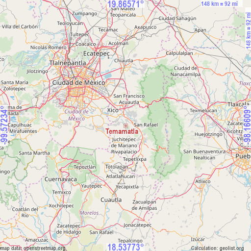
Temamatla GPS coordinates[2]
19° 12' 11.016" North, 98° 52' 9.156" West
| Map corner | latitude | longitude |
|---|---|---|
| Upper-left | 19.86571°, | -99.57234° |
| Center: | 19.20306°, | -98.86921° |
| Lower-right: | 18.53773°, | -98.16609° |
| Map W x H: | 147.7×147.7 km | = 91.8×91.8mi |
| max Lat: | 32.7° ⇑61.1% North |
| Temamatla: | 19.20306° |
| min Lat: | ⇓38.9% South 14.53588° |
| min Long | Temamatla | max Long |
| -117.105° | -98.86921° | -86.73105° |
| W 52.5%⇐ | ⇒47.5% E |
Elevation
Elevation of Temamatla is 2278 m = 7474 ft, and this is 1024.3 m = 3361 ft above average elevation for this country.
| Max E: |
3497 m = 11473 ft | 14.1% |
| Temamatla | 2278 m 7474 ft | |
| Avg. | 1253.7 m = 4113 ft | |
Min E: |
-1 m = -3 ft | 85.9% |
See also: Mexico elevation on elevation.city.
Geographical zone
Temamatla is located in North Torrid zone (between Equator and Tropic of Cancer). Distance of this Northern Tropic circle is 470.7 km =292.5 mi to North.| Distance of | km | miles | from Temamatla |
|---|---|---|---|
| North Pole | 7871.9 | 4891.4 | to North |
| Arctic Circle | 5266 | 3272.1 | to North |
| Tropic Cancer | 470.7 | 292.5 | to North |
| Equator | 2135.2 | 1326.8 | to South |


Nearby cities:
15 places around Temamatla: (largest is in red/bold)
• Cocotitlán
3.4 km =2.1 mi,  5°
5°
• Colonia Michoacana
4.4 km =2.7 mi,  272°
272°
• Colonia San José
3.1 km =1.9 mi,  280°
280°
• Ejido Atoyac
3.4 km =2.1 mi,  39°
39°
• El Cabi
2.2 km =1.4 mi,  132°
132°
• El Recodo de San José Axalco
3.5 km =2.2 mi, 269°
• Ex-Hacienda de Guadalupe
5.5 km =3.4 mi,  27°
27°
• La Candelaria Tlapala
4.7 km =2.9 mi, 28°
• Lomas de San Pablo
5.1 km =3.2 mi, 269°
• Los Reyes Acatlixhuayán
1.5 km =0.9 mi,  295°
295°
• San Andrés Metla
3.3 km =2.1 mi,  61°
61°
• San Gregorio Cuautzingo
6.4 km =4 mi, 11°
• San Pablo Atlazalpan
4.3 km =2.7 mi,  291°
291°
• Tenango del Aire
5.2 km =3.2 mi,  165°
165°
• Zula
2.9 km =1.8 mi,  311°
311°
Sources, notices
• [Note1] Compared only with cities in Mexico existing in our database
• [Src1] Map data: © OpenStreetMap contributors (CC-BY-SA)
• [Src2] Other city data from geonames.org with taken over terms of usage.
• [Src3] Geographical zone / Annual Mean Temperature by Robert A. Rohde @ Wikipedia
