Colonia Obrera geodata
Colonia Obrera (Puebla) is a populated place; located in Mexico in America/Mexico_City (GMT-6) time zone. With population of 1,258 people, there are 6880 cities with bigger population in this country. Compared to other cities in Mexico, 60.4% of cities are located further ↑North; 66.1% of cities are located further ←West and 89.2% of cities have lower elevation than Colonia Obrera. Note1


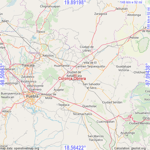
Colonia Obrera GPS coordinates[2]
19° 13' 45.984" North, 97° 47' 51" West
| Map corner | latitude | longitude |
|---|---|---|
| Upper-left | 19.89198°, | -98.50063° |
| Center: | 19.22944°, | -97.7975° |
| Lower-right: | 18.56422°, | -97.09438° |
| Map W x H: | 147.6×147.6 km | = 91.7×91.7mi |
| max Lat: | 32.7° ⇑60.4% North |
| Colonia Obrera: | 19.22944° |
| min Lat: | ⇓39.6% South 14.53588° |
| min Long | Colonia Obrera | max Long |
| -117.105° | -97.7975° | -86.73105° |
| W 66.1%⇐ | ⇒33.9% E |
Elevation
Elevation of Colonia Obrera is 2380 m = 7808 ft, and this is 1126.3 m = 3695 ft above average elevation for this country.
| Max E: |
3497 m = 11473 ft | 10.8% |
| Colonia Obrera | 2380 m 7808 ft | |
| Avg. | 1253.7 m = 4113 ft | |
Min E: |
-1 m = -3 ft | 89.2% |
See also: Mexico elevation on elevation.city.
Geographical zone
Colonia Obrera is located in North Torrid zone (between Equator and Tropic of Cancer). Distance of this Northern Tropic circle is 467.8 km =290.7 mi to North.| Distance of | km | miles | from Colonia Obrera |
|---|---|---|---|
| North Pole | 7868.9 | 4889.5 | to North |
| Arctic Circle | 5263.1 | 3270.3 | to North |
| Tropic Cancer | 467.8 | 290.7 | to North |
| Equator | 2138.1 | 1328.6 | to South |


Nearby cities:
15 places around Colonia Obrera: (largest is in red/bold)
• Colonia Benito Juárez
8.4 km =5.2 mi,  171°
171°
• Cuapiaxtla
8 km =5 mi,  22°
22°
• Eréndira
9.1 km =5.7 mi,  158°
158°
• Grajales
0.6 km =0.4 mi,  254°
254°
• Ixtenco
10.4 km =6.5 mi,  283°
283°
• Juan de la Granja
1.5 km =0.9 mi,  232°
232°
• Libertad Álvaro Obregón
11 km =6.8 mi, 163°
• Máximo Serdán
4.9 km =3 mi,  319°
319°
• Nopalucán
2.9 km =1.8 mi, 245°
• Plan de Ayala
10.8 km =6.7 mi,  34°
34°
• San José Chiapa
3.5 km =2.2 mi,  68°
68°
• San José Ozumba
7.3 km =4.5 mi,  86°
86°
• San Juan Bautista Mier
6.9 km =4.3 mi, 275°
• Santa María Ixtiyucán
4.9 km =3 mi,  196°
196°
• Unidad Grajales INFONAVIT
1.9 km =1.2 mi,  313°
313°
Sources, notices
• [Note1] Compared only with cities in Mexico existing in our database
• [Src1] Map data: © OpenStreetMap contributors (CC-BY-SA)
• [Src2] Other city data from geonames.org with taken over terms of usage.
• [Src3] Geographical zone / Annual Mean Temperature by Robert A. Rohde @ Wikipedia
