Libertad Álvaro Obregón geodata
Libertad Álvaro Obregón (Puebla) is a populated place; located in Mexico in America/Mexico_City (GMT-6) time zone. With population of 1,096 people, there are 7931 cities with bigger population in this country. Compared to other cities in Mexico, 62.5% of cities are located further ↑North; 66.5% of cities are located further ←West and 89.7% of cities have lower elevation than Libertad Álvaro Obregón. Note1
Current local time in Libertad Álvaro Obregón:
10:23 AM, MondayDifference from your time zone: hours


Libertad Álvaro Obregón GPS coordinates[2]
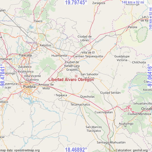
19° 8' 4.272" North, 97° 46' 2.208" West
| Map corner | latitude | longitude |
|---|---|---|
| Upper-left | 19.79745°, | -98.47041° |
| Center: | 19.13452°, | -97.76728° |
| Lower-right: | 18.46892°, | -97.06416° |
| Map W x H: | 147.7×147.7 km | = 91.8×91.8mi |
| max Lat: | 32.7° ⇑62.5% North |
| Libertad Álvaro Obregón: | 19.13452° |
| min Lat: | ⇓37.5% South 14.53588° |
| min Long | Libertad Álvar | max Long |
| -117.105° | -97.76728° | -86.73105° |
| W 66.5%⇐ | ⇒33.5% E |
Elevation
Elevation of Libertad Álvaro Obregón is 2395 m = 7858 ft, and this is 1141.3 m = 3744 ft above average elevation for this country.
| Max E: |
3497 m = 11473 ft | 10.3% |
| Libertad Álvaro Obregón | 2395 m 7858 ft | |
| Avg. | 1253.7 m = 4113 ft | |
Min E: |
-1 m = -3 ft | 89.7% |
See also: Mexico elevation on elevation.city.
Geographical zone
Libertad Álvaro Obregón is located in North Torrid zone (between Equator and Tropic of Cancer). Distance of this Northern Tropic circle is 478.4 km =297.3 mi to North.| Distance of | km | miles | from Libertad Álvaro Obregón |
|---|---|---|---|
| North Pole | 7879.5 | 4896.1 | to North |
| Arctic Circle | 5273.6 | 3276.9 | to North |
| Tropic Cancer | 478.4 | 297.3 | to North |
| Equator | 2127.6 | 1322 | to South |


Nearby cities:
15 places around Libertad Álvaro Obregón: (largest is in red/bold)
• Colonia Benito Juárez
3 km =1.9 mi,  320°
320°
• Eréndira
2 km =1.2 mi,  3°
3°
• Hernández
5.7 km =3.5 mi,  216°
216°
• Juan de la Granja
10.6 km =6.6 mi,  335°
335°
• La Ermita
2.7 km =1.7 mi,  230°
230°
• Manuel Ávila Camacho (La Cima)
4.6 km =2.9 mi,  260°
260°
• Mazapiltepec
7 km =4.3 mi,  104°
104°
• San Martín Rinconada
10.7 km =6.6 mi, 97°
• San Mateo Soltepec
4 km =2.5 mi,  169°
169°
• San Sebastián Villanueva
9.6 km =6 mi,  148°
148°
• Santa Cuz del Bosque
6.9 km =4.3 mi,  269°
269°
• Santa María Ixtiyucán
7.4 km =4.6 mi, 321°
• Soltepec
6.3 km =3.9 mi, 103°
• Vincente Guerrero
9.9 km =6.2 mi,  211°
211°
• Vista Hermosa
4.2 km =2.6 mi,  115°
115°
Sources, notices
• [Note1] Compared only with cities in Mexico existing in our database
• [Src1] Map data: © OpenStreetMap contributors (CC-BY-SA)
• [Src2] Other city data from geonames.org with taken over terms of usage.
• [Src3] Geographical zone / Annual Mean Temperature by Robert A. Rohde @ Wikipedia
