Sección 23 geodata
Sección 23 (Puebla) is a populated place; located in Mexico in America/Mexico_City (GMT-6) time zone. With population of 1,258 people, there are 6880 cities with bigger population in this country. Compared to other cities in Mexico, 52.5% of cities are located further ↓South; 70.8% of cities are located further ←West and 83.5% of cities have lower elevation than Sección 23. Note1


Sección 23 GPS coordinates[2]
19° 47' 16.008" North, 97° 22' 45.012" West
| Map corner | latitude | longitude |
|---|---|---|
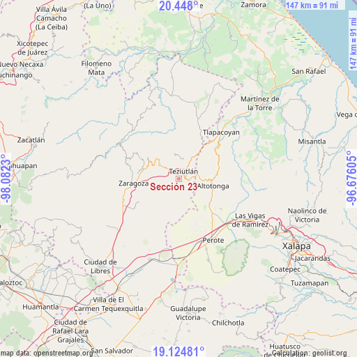
| Upper-left | 20.448°, | -98.0823° |
| Center: | 19.78778°, | -97.37917° |
| Lower-right: | 19.12481°, | -96.67605° |
| Map W x H: | 147.1×147.1 km | = 91.4×91.4mi |
| max Lat: | 32.7° ⇑47.5% North |
| Sección 23: | 19.78778° |
| min Lat: | ⇓52.5% South 14.53588° |
| min Long | Sección 23 | max Long |
| -117.105° | -97.37917° | -86.73105° |
| W 70.8%⇐ | ⇒29.2% E |
Elevation
Elevation of Sección 23 is 2232 m = 7323 ft, and this is 978.3 m = 3210 ft above average elevation for this country.
| Max E: |
3497 m = 11473 ft | 16.5% |
| Sección 23 | 2232 m 7323 ft | |
| Avg. | 1253.7 m = 4113 ft | |
Min E: |
-1 m = -3 ft | 83.5% |
See also: Mexico elevation on elevation.city.
Geographical zone
Sección 23 is located in North Torrid zone (between Equator and Tropic of Cancer). Distance of this Northern Tropic circle is 405.7 km =252.1 mi to North.| Distance of | km | miles | from Sección 23 |
|---|---|---|---|
| North Pole | 7806.9 | 4851 | to North |
| Arctic Circle | 5201 | 3231.8 | to North |
| Tropic Cancer | 405.7 | 252.1 | to North |
| Equator | 2200.2 | 1367.1 | to South |


Nearby cities:
15 places around Sección 23: (largest is in red/bold)
• Analco
4 km =2.5 mi,  327°
327°
• Chinautla
3.7 km =2.3 mi,  344°
344°
• Coahuixco
3.8 km =2.4 mi,  301°
301°
• Crutzitzin
1.9 km =1.2 mi, 302°
• Cuaxoxpan
4.2 km =2.6 mi,  57°
57°
• San Andrés
4.2 km =2.6 mi,  86°
86°
• San Antonio
4.2 km =2.6 mi,  146°
146°
• San Isidro
1.1 km =0.7 mi, 334°
• San Martín
4.1 km =2.5 mi,  98°
98°
• Sosa
2.3 km =1.4 mi,  309°
309°
• Talzintán
4 km =2.5 mi,  287°
287°
• Tequimila
4 km =2.5 mi,  356°
356°
• Teziutlan
3.9 km =2.4 mi,  31°
31°
• Tezohuatepec (Tezotepec)
3.2 km =2 mi,  319°
319°
• Yopi
4.3 km =2.7 mi, 358°
Sources, notices
• [Note1] Compared only with cities in Mexico existing in our database
• [Src1] Map data: © OpenStreetMap contributors (CC-BY-SA)
• [Src2] Other city data from geonames.org with taken over terms of usage.
• [Src3] Geographical zone / Annual Mean Temperature by Robert A. Rohde @ Wikipedia
