Tezohuatepec (Tezotepec) geodata
Tezohuatepec (Tezotepec) (Puebla) is a populated place; located in Mexico in America/Mexico_City (GMT-6) time zone. With population of 510 people, there are 16480 cities with bigger population in this country. Compared to other cities in Mexico, 53% of cities are located further ↓South; 70.6% of cities are located further ←West and 78.6% of cities have lower elevation than Tezohuatepec (Tezotepec). Note1
Current local time in Tezohuatepec (Tezotepec):
06:40 AM, WednesdayDifference from your time zone: hours


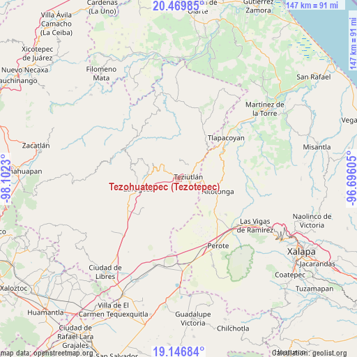
Tezohuatepec (Tezotepec) GPS coordinates[2]
19° 48' 34.992" North, 97° 23' 57.012" West
| Map corner | latitude | longitude |
|---|---|---|
| Upper-left | 20.46985°, | -98.1023° |
| Center: | 19.80972°, | -97.39917° |
| Lower-right: | 19.14684°, | -96.69605° |
| Map W x H: | 147.1×147.1 km | = 91.4×91.4mi |
| max Lat: | 32.7° ⇑47% North |
| Tezohuatepec (Tezotepec): | 19.80972° |
| min Lat: | ⇓53% South 14.53588° |
| min Long | Tezohuatepec (T | max Long |
| -117.105° | -97.39917° | -86.73105° |
| W 70.6%⇐ | ⇒29.4% E |
Elevation
Elevation of Tezohuatepec (Tezotepec) is 2103 m = 6900 ft, and this is 849.3 m = 2786 ft above average elevation for this country.
| Max E: |
3497 m = 11473 ft | 21.4% |
| Tezohuatepec (Tezotepec) | 2103 m 6900 ft | |
| Avg. | 1253.7 m = 4113 ft | |
Min E: |
-1 m = -3 ft | 78.6% |
See also: Mexico elevation on elevation.city.
Geographical zone
Tezohuatepec (Tezotepec) is located in North Torrid zone (between Equator and Tropic of Cancer). Distance of this Northern Tropic circle is 403.3 km =250.6 mi to North.| Distance of | km | miles | from Tezohuatepec (Tezotepec) |
|---|---|---|---|
| North Pole | 7804.4 | 4849.4 | to North |
| Arctic Circle | 5198.5 | 3230.2 | to North |
| Tropic Cancer | 403.3 | 250.6 | to North |
| Equator | 2202.6 | 1368.6 | to South |


Nearby cities:
15 places around Tezohuatepec (Tezotepec): (largest is in red/bold)
• Analco
1 km =0.6 mi,  356°
356°
• Cala Sur
3.4 km =2.1 mi,  318°
318°
• Chinautla
1.6 km =1 mi,  44°
44°
• Coahuixco
1.3 km =0.8 mi,  248°
248°
• Crutzitzin
1.5 km =0.9 mi,  159°
159°
• San Isidro
2.2 km =1.4 mi,  132°
132°
• Sección 23
3.2 km =2 mi,  139°
139°
• Sosa
1 km =0.6 mi, 161°
• Tacopan
4.6 km =2.9 mi,  312°
312°
• Talzintán
2.2 km =1.4 mi,  233°
233°
• Tepepan
3.1 km =1.9 mi,  34°
34°
• Tequimila
2.4 km =1.5 mi,  50°
50°
• Teziutlan
4.2 km =2.6 mi,  78°
78°
• Xoloateno
3.9 km =2.4 mi, 52°
• Yopi
2.7 km =1.7 mi, 46°
Sources, notices
• [Note1] Compared only with cities in Mexico existing in our database
• [Src1] Map data: © OpenStreetMap contributors (CC-BY-SA)
• [Src2] Other city data from geonames.org with taken over terms of usage.
• [Src3] Geographical zone / Annual Mean Temperature by Robert A. Rohde @ Wikipedia
