Coahuixco geodata
Coahuixco (Puebla) is a populated place; located in Mexico in America/Mexico_City (GMT-6) time zone. With population of 2,566 people, there are 3450 cities with bigger population in this country. Compared to other cities in Mexico, 52.9% of cities are located further ↓South; 70.5% of cities are located further ←West and 80% of cities have lower elevation than Coahuixco. Note1


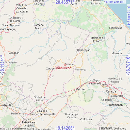
Coahuixco GPS coordinates[2]
19° 48' 20.016" North, 97° 24' 37.008" West
| Map corner | latitude | longitude |
|---|---|---|
| Upper-left | 20.46571°, | -98.11341° |
| Center: | 19.80556°, | -97.41028° |
| Lower-right: | 19.14266°, | -96.70716° |
| Map W x H: | 147.1×147.1 km | = 91.4×91.4mi |
| max Lat: | 32.7° ⇑47.1% North |
| Coahuixco: | 19.80556° |
| min Lat: | ⇓52.9% South 14.53588° |
| min Long | Coahuixco | max Long |
| -117.105° | -97.41028° | -86.73105° |
| W 70.5%⇐ | ⇒29.5% E |
Elevation
Elevation of Coahuixco is 2141 m = 7024 ft, and this is 887.3 m = 2911 ft above average elevation for this country.
| Max E: |
3497 m = 11473 ft | 20% |
| Coahuixco | 2141 m 7024 ft | |
| Avg. | 1253.7 m = 4113 ft | |
Min E: |
-1 m = -3 ft | 80% |
See also: Mexico elevation on elevation.city.
Geographical zone
Coahuixco is located in North Torrid zone (between Equator and Tropic of Cancer). Distance of this Northern Tropic circle is 403.7 km =250.8 mi to North.| Distance of | km | miles | from Coahuixco |
|---|---|---|---|
| North Pole | 7804.9 | 4849.7 | to North |
| Arctic Circle | 5199 | 3230.5 | to North |
| Tropic Cancer | 403.7 | 250.8 | to North |
| Equator | 2202.2 | 1368.4 | to South |


Nearby cities:
15 places around Coahuixco: (largest is in red/bold)
• Analco
1.8 km =1.1 mi,  37°
37°
• Apatauyan
3.6 km =2.2 mi,  258°
258°
• Atzalán
4.1 km =2.5 mi,  301°
301°
• Cala Sur
3.2 km =2 mi,  339°
339°
• Chinautla
2.8 km =1.7 mi,  54°
54°
• Crutzitzin
1.9 km =1.2 mi,  119°
119°
• Las Canoas
3.9 km =2.4 mi,  285°
285°
• San Ambrosio
4.1 km =2.5 mi, 292°
• San Isidro
3 km =1.9 mi,  110°
110°
• Sección 23
3.8 km =2.4 mi, 121°
• Sosa
1.6 km =1 mi, 108°
• Talzintán
1 km =0.6 mi,  215°
215°
• Tequimila
3.6 km =2.2 mi,  56°
56°
• Tezohuatepec (Tezotepec)
1.3 km =0.8 mi,  68°
68°
• Yopi
3.9 km =2.4 mi, 53°
Sources, notices
• [Note1] Compared only with cities in Mexico existing in our database
• [Src1] Map data: © OpenStreetMap contributors (CC-BY-SA)
• [Src2] Other city data from geonames.org with taken over terms of usage.
• [Src3] Geographical zone / Annual Mean Temperature by Robert A. Rohde @ Wikipedia
