Chinautla geodata
Chinautla (Puebla) is a populated place; located in Mexico in America/Mexico_City (GMT-6) time zone. With population of 11,096 people, there are 856 cities with bigger population in this country. Compared to other cities in Mexico, 53.3% of cities are located further ↓South; 70.7% of cities are located further ←West and 72.8% of cities have lower elevation than Chinautla. Note1


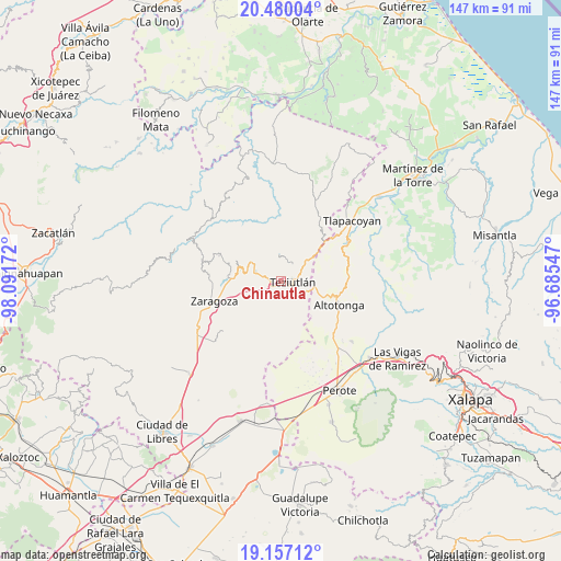
Chinautla GPS coordinates[2]
19° 49' 11.856" North, 97° 23' 18.924" West
| Map corner | latitude | longitude |
|---|---|---|
| Upper-left | 20.48004°, | -98.09172° |
| Center: | 19.81996°, | -97.38859° |
| Lower-right: | 19.15712°, | -96.68547° |
| Map W x H: | 147.1×147.1 km | = 91.4×91.4mi |
| max Lat: | 32.7° ⇑46.7% North |
| Chinautla: | 19.81996° |
| min Lat: | ⇓53.3% South 14.53588° |
| min Long | Chinautla | max Long |
| -117.105° | -97.38859° | -86.73105° |
| W 70.7%⇐ | ⇒29.3% E |
Elevation
Elevation of Chinautla is 1984 m = 6509 ft, and this is 730.3 m = 2396 ft above average elevation for this country.
| Max E: |
3497 m = 11473 ft | 27.2% |
| Chinautla | 1984 m 6509 ft | |
| Avg. | 1253.7 m = 4113 ft | |
Min E: |
-1 m = -3 ft | 72.8% |
See also: Mexico elevation on elevation.city.
Geographical zone
Chinautla is located in North Torrid zone (between Equator and Tropic of Cancer). Distance of this Northern Tropic circle is 402.1 km =249.9 mi to North.| Distance of | km | miles | from Chinautla |
|---|---|---|---|
| North Pole | 7803.3 | 4848.7 | to North |
| Arctic Circle | 5197.4 | 3229.5 | to North |
| Tropic Cancer | 402.1 | 249.9 | to North |
| Equator | 2203.8 | 1369.4 | to South |


Nearby cities:
15 places around Chinautla: (largest is in red/bold)
• Analco
1.2 km =0.7 mi,  261°
261°
• Cala Sur
3.7 km =2.3 mi,  292°
292°
• Coahuixco
2.8 km =1.7 mi,  234°
234°
• Crutzitzin
2.6 km =1.6 mi,  192°
192°
• San Isidro
2.7 km =1.7 mi,  168°
168°
• San Juan Tezongo
3.8 km =2.4 mi,  43°
43°
• Sección 23
3.7 km =2.3 mi,  164°
164°
• Sosa
2.2 km =1.4 mi,  200°
200°
• Talzintán
3.7 km =2.3 mi, 229°
• Tepepan
1.6 km =1 mi,  24°
24°
• Tequimila
0.8 km =0.5 mi,  63°
63°
• Teziutlan
3 km =1.9 mi,  95°
95°
• Tezohuatepec (Tezotepec)
1.6 km =1 mi,  224°
224°
• Xoloateno
2.4 km =1.5 mi, 58°
• Yopi
1.1 km =0.7 mi,  49°
49°
Sources, notices
• [Note1] Compared only with cities in Mexico existing in our database
• [Src1] Map data: © OpenStreetMap contributors (CC-BY-SA)
• [Src2] Other city data from geonames.org with taken over terms of usage.
• [Src3] Geographical zone / Annual Mean Temperature by Robert A. Rohde @ Wikipedia
