Talzintán geodata
Talzintán (Puebla) is a populated place; located in Mexico in America/Mexico_City (GMT-6) time zone. With population of 767 people, there are 11411 cities with bigger population in this country. Compared to other cities in Mexico, 52.7% of cities are located further ↓South; 70.4% of cities are located further ←West and 82.6% of cities have lower elevation than Talzintán. Note1


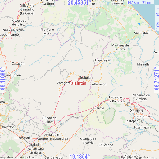
Talzintán GPS coordinates[2]
19° 47' 53.988" North, 97° 24' 56.988" West
| Map corner | latitude | longitude |
|---|---|---|
| Upper-left | 20.45851°, | -98.11896° |
| Center: | 19.79833°, | -97.41583° |
| Lower-right: | 19.1354°, | -96.71271° |
| Map W x H: | 147.1×147.1 km | = 91.4×91.4mi |
| max Lat: | 32.7° ⇑47.3% North |
| Talzintán: | 19.79833° |
| min Lat: | ⇓52.7% South 14.53588° |
| min Long | Talzintán | max Long |
| -117.105° | -97.41583° | -86.73105° |
| W 70.4%⇐ | ⇒29.6% E |
Elevation
Elevation of Talzintán is 2205 m = 7234 ft, and this is 951.3 m = 3121 ft above average elevation for this country.
| Max E: |
3497 m = 11473 ft | 17.4% |
| Talzintán | 2205 m 7234 ft | |
| Avg. | 1253.7 m = 4113 ft | |
Min E: |
-1 m = -3 ft | 82.6% |
See also: Mexico elevation on elevation.city.
Geographical zone
Talzintán is located in North Torrid zone (between Equator and Tropic of Cancer). Distance of this Northern Tropic circle is 404.6 km =251.4 mi to North.| Distance of | km | miles | from Talzintán |
|---|---|---|---|
| North Pole | 7805.7 | 4850.2 | to North |
| Arctic Circle | 5199.8 | 3231 | to North |
| Tropic Cancer | 404.6 | 251.4 | to North |
| Equator | 2201.4 | 1367.9 | to South |


Nearby cities:
15 places around Talzintán: (largest is in red/bold)
• Analco
2.8 km =1.7 mi,  37°
37°
• Apatauyan
3 km =1.9 mi,  271°
271°
• Atzalán
4.2 km =2.6 mi,  314°
314°
• Cala Sur
3.9 km =2.4 mi,  351°
351°
• Chinautla
3.7 km =2.3 mi,  49°
49°
• Coahuixco
1 km =0.6 mi, 35°
• Crutzitzin
2.3 km =1.4 mi,  93°
93°
• Las Canoas
3.6 km =2.2 mi,  300°
300°
• San Ambrosio
4 km =2.5 mi, 306°
• San Isidro
3.4 km =2.1 mi, 93°
• Sección 23
4 km =2.5 mi,  107°
107°
• Sosa
2.1 km =1.3 mi,  81°
81°
• Tacopan
4.6 km =2.9 mi,  339°
339°
• Tequimila
4.6 km =2.9 mi, 52°
• Tezohuatepec (Tezotepec)
2.2 km =1.4 mi, 53°
Sources, notices
• [Note1] Compared only with cities in Mexico existing in our database
• [Src1] Map data: © OpenStreetMap contributors (CC-BY-SA)
• [Src2] Other city data from geonames.org with taken over terms of usage.
• [Src3] Geographical zone / Annual Mean Temperature by Robert A. Rohde @ Wikipedia
