San Felipe Sultepec geodata
San Felipe Sultepec (Tlaxcala) is a populated place; located in Mexico in America/Mexico_City (GMT-6) time zone. With population of 1,117 people, there are 7781 cities with bigger population in this country. Compared to other cities in Mexico, 52.1% of cities are located further ↑North; 55.9% of cities are located further ←West and 95.5% of cities have lower elevation than San Felipe Sultepec. Note1


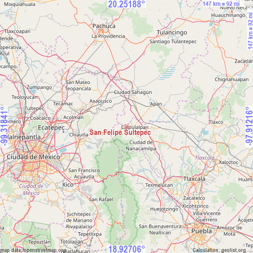
San Felipe Sultepec GPS coordinates[2]
19° 35' 26.988" North, 98° 36' 55.008" West
| Map corner | latitude | longitude |
|---|---|---|
| Upper-left | 20.25188°, | -99.31841° |
| Center: | 19.59083°, | -98.61528° |
| Lower-right: | 18.92706°, | -97.91216° |
| Map W x H: | 147.3×147.3 km | = 91.5×91.5mi |
| max Lat: | 32.7° ⇑52.1% North |
| San Felipe Sultepec: | 19.59083° |
| min Lat: | ⇓47.9% South 14.53588° |
| min Long | San Felipe Sult | max Long |
| -117.105° | -98.61528° | -86.73105° |
| W 55.9%⇐ | ⇒44.1% E |
Elevation
Elevation of San Felipe Sultepec is 2607 m = 8553 ft, and this is 1353.3 m = 4440 ft above average elevation for this country.
| Max E: |
3497 m = 11473 ft | 4.5% |
| San Felipe Sultepec | 2607 m 8553 ft | |
| Avg. | 1253.7 m = 4113 ft | |
Min E: |
-1 m = -3 ft | 95.5% |
See also: Mexico elevation on elevation.city.
Geographical zone
San Felipe Sultepec is located in North Torrid zone (between Equator and Tropic of Cancer). Distance of this Northern Tropic circle is 427.6 km =265.7 mi to North.| Distance of | km | miles | from San Felipe Sultepec |
|---|---|---|---|
| North Pole | 7828.8 | 4864.6 | to North |
| Arctic Circle | 5222.9 | 3245.4 | to North |
| Tropic Cancer | 427.6 | 265.7 | to North |
| Equator | 2178.3 | 1353.5 | to South |


Nearby cities:
15 places around San Felipe Sultepec: (largest is in red/bold)
• Calpulalpan
4.8 km =3 mi,  92°
92°
• Chimalpa y Tlalayote
13.6 km =8.5 mi,  52°
52°
• Ciudad de Nanacamilpa
13.6 km =8.5 mi,  142°
142°
• Emiliano Zapata
10.2 km =6.3 mi, 45°
• José María Morelos (San José)
11 km =6.8 mi,  21°
21°
• La Soledad
5.8 km =3.6 mi,  182°
182°
• Mazapa
8.3 km =5.2 mi,  132°
132°
• San Cristobal
5.5 km =3.4 mi,  242°
242°
• San Felipe Hidalgo
14.9 km =9.3 mi,  156°
156°
• San Juan Totolapan
13.5 km =8.4 mi, 240°
• San Marcos Guaquilpan
1.6 km =1 mi,  301°
301°
• Santa Bárbara
9.7 km =6 mi,  29°
29°
• Santa Clara
12.6 km =7.8 mi, 18°
• Santiago Cuaula
3.8 km =2.4 mi,  288°
288°
• Zotoluca
11.1 km =6.9 mi,  78°
78°
Sources, notices
• [Note1] Compared only with cities in Mexico existing in our database
• [Src1] Map data: © OpenStreetMap contributors (CC-BY-SA)
• [Src2] Other city data from geonames.org with taken over terms of usage.
• [Src3] Geographical zone / Annual Mean Temperature by Robert A. Rohde @ Wikipedia
