Eshpuilho geodata
Eshpuilho (Chiapas) is a populated place; located in Mexico in America/Mexico_City (GMT-6) time zone. With population of 795 people, there are 10969 cities with bigger population in this country. Compared to other cities in Mexico, 92.8% of cities are located further ↑North; 92.1% of cities are located further ←West and 82.9% of cities have lower elevation than Eshpuilho. Note1


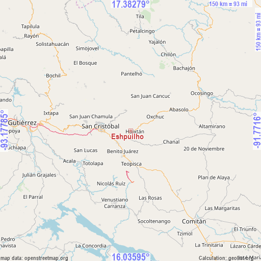
Eshpuilho GPS coordinates[2]
16° 42' 38.016" North, 92° 28' 28.992" West
| Map corner | latitude | longitude |
|---|---|---|
| Upper-left | 17.38279°, | -93.17785° |
| Center: | 16.71056°, | -92.47472° |
| Lower-right: | 16.03595°, | -91.7716° |
| Map W x H: | 149.8×149.8 km | = 93.1×93.1mi |
| max Lat: | 32.7° ⇑92.8% North |
| Eshpuilho: | 16.71056° |
| min Lat: | ⇓7.2% South 14.53588° |
| min Long | Eshpuilho | max Long |
| -117.105° | -92.47472° | -86.73105° |
| W 92.1%⇐ | ⇒7.9% E |
Elevation
Elevation of Eshpuilho is 2212 m = 7257 ft, and this is 958.3 m = 3144 ft above average elevation for this country.
| Max E: |
3497 m = 11473 ft | 17.1% |
| Eshpuilho | 2212 m 7257 ft | |
| Avg. | 1253.7 m = 4113 ft | |
Min E: |
-1 m = -3 ft | 82.9% |
See also: Mexico elevation on elevation.city.
Geographical zone
Eshpuilho is located in North Torrid zone (between Equator and Tropic of Cancer). Distance of this Northern Tropic circle is 747.9 km =464.7 mi to North.| Distance of | km | miles | from Eshpuilho |
|---|---|---|---|
| North Pole | 8149 | 5063.6 | to North |
| Arctic Circle | 5543.1 | 3444.3 | to North |
| Tropic Cancer | 747.9 | 464.7 | to North |
| Equator | 1858 | 1154.5 | to South |


Nearby cities:
15 places around Eshpuilho: (largest is in red/bold)
• Adolfo López Mateos
7.9 km =4.9 mi,  54°
54°
• Buenavista
6.6 km =4.1 mi,  136°
136°
• Chanal
8 km =5 mi,  85°
85°
• Corazón de María
6.5 km =4 mi,  258°
258°
• El Escalón
4.6 km =2.9 mi, 264°
• Huixtán
2.3 km =1.4 mi, 89°
• Jocosic
6.2 km =3.9 mi,  17°
17°
• La Candelaria
6.1 km =3.8 mi,  305°
305°
• La Sierra
7.3 km =4.5 mi,  272°
272°
• La Soledad
6.1 km =3.8 mi,  231°
231°
• Lázaro Cárdenas (Chilil)
4.1 km =2.5 mi,  201°
201°
• Oquem
1.6 km =1 mi,  344°
344°
• San Andrés Puerto Rico
7.7 km =4.8 mi,  99°
99°
• San José Yashitinín
7 km =4.3 mi,  152°
152°
• San Pedro la Tejería
4.3 km =2.7 mi,  297°
297°
Sources, notices
• [Note1] Compared only with cities in Mexico existing in our database
• [Src1] Map data: © OpenStreetMap contributors (CC-BY-SA)
• [Src2] Other city data from geonames.org with taken over terms of usage.
• [Src3] Geographical zone / Annual Mean Temperature by Robert A. Rohde @ Wikipedia
