Tzinil geodata
Tzinil (Chiapas) is a populated place; located in Mexico in America/Mexico_City (GMT-6) time zone. With population of 1,106 people, there are 7864 cities with bigger population in this country. Compared to other cities in Mexico, 96% of cities are located further ↑North; 93.2% of cities are located further ←West and 56% of cities have higher elevation than Tzinil. Note1


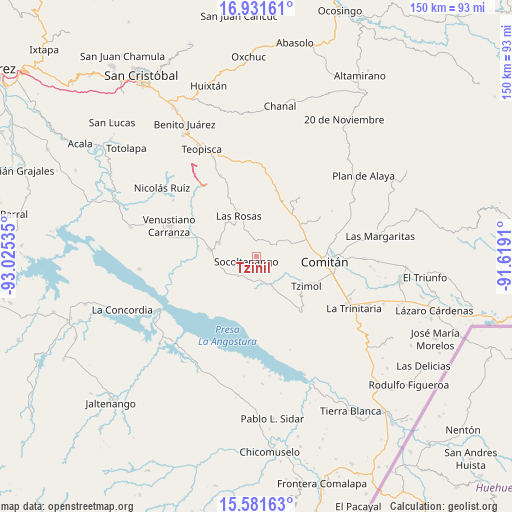
Tzinil GPS coordinates[2]
16° 15' 28.008" North, 92° 19' 19.992" West
| Map corner | latitude | longitude |
|---|---|---|
| Upper-left | 16.93161°, | -93.02535° |
| Center: | 16.25778°, | -92.32222° |
| Lower-right: | 15.58163°, | -91.6191° |
| Map W x H: | 150.1×150.1 km | = 93.3×93.3mi |
| max Lat: | 32.7° ⇑96% North |
| Tzinil: | 16.25778° |
| min Lat: | ⇓4% South 14.53588° |
| min Long | Tzinil | max Long |
| -117.105° | -92.32222° | -86.73105° |
| W 93.2%⇐ | ⇒6.8% E |
Elevation
Elevation of Tzinil is 1161 m = 3809 ft, and this is 92.7 m = 304 ft below average elevation for this country.
| Max E: |
3497 m = 11473 ft | 56% |
| Avg. | 1253.7 m = 4113 ft | |
| Tzinil | 1161 m = 3809 ft | |
Min E: |
-1 m = -3 ft | 44% |
See also: Mexico elevation on elevation.city.
Geographical zone
Tzinil is located in North Torrid zone (between Equator and Tropic of Cancer). Distance of this Northern Tropic circle is 798.2 km =496 mi to North.| Distance of | km | miles | from Tzinil |
|---|---|---|---|
| North Pole | 8199.4 | 5094.9 | to North |
| Arctic Circle | 5593.5 | 3475.6 | to North |
| Tropic Cancer | 798.2 | 496 | to North |
| Equator | 1807.7 | 1123.3 | to South |


Nearby cities:
15 places around Tzinil: (largest is in red/bold)
• Abelardo L. Rodríguez
16.3 km =10.1 mi,  32°
32°
• Chacaljocóm
15.5 km =9.6 mi,  72°
72°
• Corral Hierba
14.6 km =9.1 mi,  312°
312°
• Efraín A. Gutiérrez
16.3 km =10.1 mi,  53°
53°
• Emiliano Zapata
13 km =8.1 mi,  230°
230°
• Francisco Villa
9.3 km =5.8 mi,  153°
153°
• Las Rosas
13.1 km =8.1 mi,  336°
336°
• Ochusjob
8.3 km =5.2 mi,  116°
116°
• San Francisco Pujiltic
14.2 km =8.8 mi,  279°
279°
• San Vicente la Mesilla
9.3 km =5.8 mi,  160°
160°
• Socoltenango
3.3 km =2.1 mi,  244°
244°
• Soyatitán
11.6 km =7.2 mi,  290°
290°
• Tzimol
16.4 km =10.2 mi, 120°
• Yaltzi Tres Lagunas
8.2 km =5.1 mi,  55°
55°
• Zacualpa
8 km =5 mi, 309°
Sources, notices
• [Note1] Compared only with cities in Mexico existing in our database
• [Src1] Map data: © OpenStreetMap contributors (CC-BY-SA)
• [Src2] Other city data from geonames.org with taken over terms of usage.
• [Src3] Geographical zone / Annual Mean Temperature by Robert A. Rohde @ Wikipedia
