El Cabi geodata
El Cabi (State of Mexico) is a populated place; located in Mexico in America/Mexico_City (GMT-6) time zone. With population of 1,093 people, there are 7958 cities with bigger population in this country. Compared to other cities in Mexico, 61.4% of cities are located further ↑North; 52.7% of cities are located further ←West and 88.7% of cities have lower elevation than El Cabi. Note1


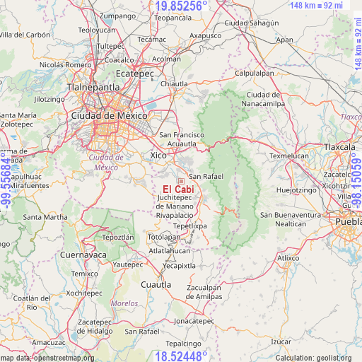
El Cabi GPS coordinates[2]
19° 11' 23.496" North, 98° 51' 13.356" West
| Map corner | latitude | longitude |
|---|---|---|
| Upper-left | 19.85256°, | -99.55684° |
| Center: | 19.18986°, | -98.85371° |
| Lower-right: | 18.52448°, | -98.15059° |
| Map W x H: | 147.7×147.7 km | = 91.8×91.8mi |
| max Lat: | 32.7° ⇑61.4% North |
| El Cabi: | 19.18986° |
| min Lat: | ⇓38.6% South 14.53588° |
| min Long | El Cabi | max Long |
| -117.105° | -98.85371° | -86.73105° |
| W 52.7%⇐ | ⇒47.3% E |
Elevation
Elevation of El Cabi is 2362 m = 7749 ft, and this is 1108.3 m = 3636 ft above average elevation for this country.
| Max E: |
3497 m = 11473 ft | 11.3% |
| El Cabi | 2362 m 7749 ft | |
| Avg. | 1253.7 m = 4113 ft | |
Min E: |
-1 m = -3 ft | 88.7% |
See also: Mexico elevation on elevation.city.
Geographical zone
El Cabi is located in North Torrid zone (between Equator and Tropic of Cancer). Distance of this Northern Tropic circle is 472.2 km =293.4 mi to North.| Distance of | km | miles | from El Cabi |
|---|---|---|---|
| North Pole | 7873.3 | 4892.2 | to North |
| Arctic Circle | 5267.5 | 3273.1 | to North |
| Tropic Cancer | 472.2 | 293.4 | to North |
| Equator | 2133.7 | 1325.8 | to South |


Nearby cities:
15 places around El Cabi: (largest is in red/bold)
• Cocotitlán
5 km =3.1 mi,  345°
345°
• Colonia San José
5.1 km =3.2 mi,  293°
293°
• Ejido Atoyac
4.1 km =2.5 mi,  7°
7°
• El Recodo de San José Axalco
5.3 km =3.3 mi, 285°
• La Candelaria Tlapala
5.7 km =3.5 mi, 6°
• Los Reyes Acatlixhuayán
3.7 km =2.3 mi,  305°
305°
• Miraflores
6 km =3.7 mi,  53°
53°
• San Andrés Metla
3.3 km =2.1 mi,  22°
22°
• San Juan Coxtocan
5.7 km =3.5 mi,  173°
173°
• Santiago Tepopula
5.1 km =3.2 mi,  183°
183°
• Temamatla
2.2 km =1.4 mi, 312°
• Tenango del Aire
3.6 km =2.2 mi,  185°
185°
• Tlalmanalco
5.8 km =3.6 mi,  72°
72°
• Tlamapa
5.7 km =3.5 mi,  161°
161°
• Zula
5 km =3.1 mi, 311°
Sources, notices
• [Note1] Compared only with cities in Mexico existing in our database
• [Src1] Map data: © OpenStreetMap contributors (CC-BY-SA)
• [Src2] Other city data from geonames.org with taken over terms of usage.
• [Src3] Geographical zone / Annual Mean Temperature by Robert A. Rohde @ Wikipedia
