Nicolás Blanco (San Pancho) geodata
Nicolás Blanco (San Pancho) (Veracruz) is a populated place; located in Mexico in America/Mexico_City (GMT-6) time zone. With population of 1,092 people, there are 7964 cities with bigger population in this country. Compared to other cities in Mexico, 57.5% of cities are located further ↑North; 80.6% of cities are located further ←West and 94.6% of cities have higher elevation than Nicolás Blanco (San Pancho). Note1
Current local time in Nicolás Blanco (San Pancho):
08:30 AM, WednesdayDifference from your time zone: hours


Nicolás Blanco (San Pancho) GPS coordinates[2]
19° 21' 9" North, 96° 20' 17.988" West
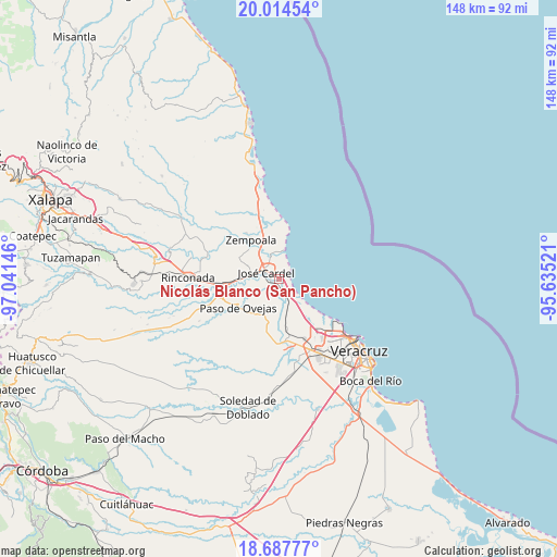
| Map corner | latitude | longitude |
|---|---|---|
| Upper-left | 20.01454°, | -97.04146° |
| Center: | 19.3525°, | -96.33833° |
| Lower-right: | 18.68777°, | -95.63521° |
| Map W x H: | 147.5×147.5 km | = 91.7×91.7mi |
| max Lat: | 32.7° ⇑57.5% North |
| Nicolás Blanco (San Pancho): | 19.3525° |
| min Lat: | ⇓42.5% South 14.53588° |
| min Long | Nicolás Blanco | max Long |
| -117.105° | -96.33833° | -86.73105° |
| W 80.6%⇐ | ⇒19.4% E |
Elevation
Elevation of Nicolás Blanco (San Pancho) is 14 m = 46 ft, and this is 1239.7 m = 4067 ft below average elevation for this country.
| Max E: |
3497 m = 11473 ft | 94.6% |
| Avg. | 1253.7 m = 4113 ft | |
| Nicolás Blanco (San Pancho) | 14 m = 46 ft | |
Min E: |
-1 m = -3 ft | 5.4% |
See also: Mexico elevation on elevation.city.
Geographical zone
Nicolás Blanco (San Pancho) is located in North Torrid zone (between Equator and Tropic of Cancer). Distance of this Northern Tropic circle is 454.1 km =282.2 mi to North.| Distance of | km | miles | from Nicolás Blanco (San Pancho) |
|---|---|---|---|
| North Pole | 7855.3 | 4881.1 | to North |
| Arctic Circle | 5249.4 | 3261.8 | to North |
| Tropic Cancer | 454.1 | 282.2 | to North |
| Equator | 2151.8 | 1337.1 | to South |


Nearby cities:
15 places around Nicolás Blanco (San Pancho): (largest is in red/bold)
• Bara de Chachalacas
6 km =3.7 mi,  356°
356°
• Cabezas
5.1 km =3.2 mi,  294°
294°
• El Arenal
9.1 km =5.7 mi,  335°
335°
• El Mango
6 km =3.7 mi,  237°
237°
• El Paraíso (La Charca)
8.7 km =5.4 mi,  348°
348°
• Infonavit el Pando I
7 km =4.3 mi,  317°
317°
• José Cardel
3.7 km =2.3 mi,  297°
297°
• La Antigua
4 km =2.5 mi,  152°
152°
• La Ceiba
6.2 km =3.9 mi,  228°
228°
• Loma de San Rafael
6.6 km =4.1 mi, 353°
• Playa de Chachalacas
8.1 km =5 mi,  11°
11°
• Pureza
8 km =5 mi,  163°
163°
• Salmoral
2.2 km =1.4 mi, 238°
• Yucatán
2.6 km =1.6 mi,  250°
250°
• Úrsulo Galván
6.3 km =3.9 mi, 338°
Sources, notices
• [Note1] Compared only with cities in Mexico existing in our database
• [Src1] Map data: © OpenStreetMap contributors (CC-BY-SA)
• [Src2] Other city data from geonames.org with taken over terms of usage.
• [Src3] Geographical zone / Annual Mean Temperature by Robert A. Rohde @ Wikipedia
