San Vicente Zoyatlán geodata
San Vicente Zoyatlán (Guerrero) is a populated place; located in Mexico in America/Mexico_City (GMT-6) time zone. With population of 1,911 people, there are 4550 cities with bigger population in this country. Compared to other cities in Mexico, 85% of cities are located further ↑North; 59.1% of cities are located further ←West and 76.6% of cities have lower elevation than San Vicente Zoyatlán. Note1
Current local time in San Vicente Zoyatlán:
08:44 AM, WednesdayDifference from your time zone: hours


San Vicente Zoyatlán GPS coordinates[2]
17° 19' 21" North, 98° 21' 51.012" West
| Map corner | latitude | longitude |
|---|---|---|
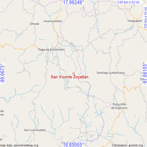
| Upper-left | 17.99249°, | -99.0673° |
| Center: | 17.3225°, | -98.36417° |
| Lower-right: | 16.65005°, | -97.66105° |
| Map W x H: | 149.3×149.3 km | = 92.8×92.8mi |
| max Lat: | 32.7° ⇑85% North |
| San Vicente Zoyatlán: | 17.3225° |
| min Lat: | ⇓15% South 14.53588° |
| min Long | San Vicente Zoy | max Long |
| -117.105° | -98.36417° | -86.73105° |
| W 59.1%⇐ | ⇒40.9% E |
Elevation
Elevation of San Vicente Zoyatlán is 2059 m = 6755 ft, and this is 805.3 m = 2642 ft above average elevation for this country.
| Max E: |
3497 m = 11473 ft | 23.4% |
| San Vicente Zoyatlán | 2059 m 6755 ft | |
| Avg. | 1253.7 m = 4113 ft | |
Min E: |
-1 m = -3 ft | 76.6% |
See also: Mexico elevation on elevation.city.
Geographical zone
San Vicente Zoyatlán is located in North Torrid zone (between Equator and Tropic of Cancer). Distance of this Northern Tropic circle is 679.8 km =422.4 mi to North.| Distance of | km | miles | from San Vicente Zoyatlán |
|---|---|---|---|
| North Pole | 8081 | 5021.3 | to North |
| Arctic Circle | 5475.1 | 3402.1 | to North |
| Tropic Cancer | 679.8 | 422.4 | to North |
| Equator | 1926.1 | 1196.8 | to South |


Nearby cities:
15 places around San Vicente Zoyatlán: (largest is in red/bold)
• Almolonga de Ocampo (Almolonga)
10.9 km =6.8 mi,  5°
5°
• Cocuilotlazala
7.1 km =4.4 mi,  250°
250°
• Huexoapa (San Juan Huexoapa)
9.7 km =6 mi,  213°
213°
• Lomazóyatl (Lomazoya)
10.8 km =6.7 mi,  288°
288°
• Melchor Ocampo
9.7 km =6 mi, 294°
• San Martín Peras
14.1 km =8.8 mi,  73°
73°
• San Miguel Peras
13.2 km =8.2 mi,  89°
89°
• San Pablo Atzompa
8.4 km =5.2 mi,  184°
184°
• San Rafael
12.4 km =7.7 mi, 210°
• Santiago Petlacala
8.4 km =5.2 mi,  107°
107°
• Santiago Tilapa
13 km =8.1 mi,  122°
122°
• Tierra Blanca
12.5 km =7.8 mi,  242°
242°
• Tlahuapa
6.5 km =4 mi,  25°
25°
• Xochapa
11.5 km =7.1 mi,  306°
306°
• Yuvinani
12.6 km =7.8 mi,  194°
194°
Sources, notices
• [Note1] Compared only with cities in Mexico existing in our database
• [Src1] Map data: © OpenStreetMap contributors (CC-BY-SA)
• [Src2] Other city data from geonames.org with taken over terms of usage.
• [Src3] Geographical zone / Annual Mean Temperature by Robert A. Rohde @ Wikipedia
