Barrio Segundo geodata
Barrio Segundo (Veracruz) is a populated place; located in Mexico in America/Mexico_City (GMT-6) time zone. With population of 962 people, there are 9047 cities with bigger population in this country. Compared to other cities in Mexico, 71.5% of cities are located further ↑North; 75% of cities are located further ←West and 58.2% of cities have lower elevation than Barrio Segundo. Note1


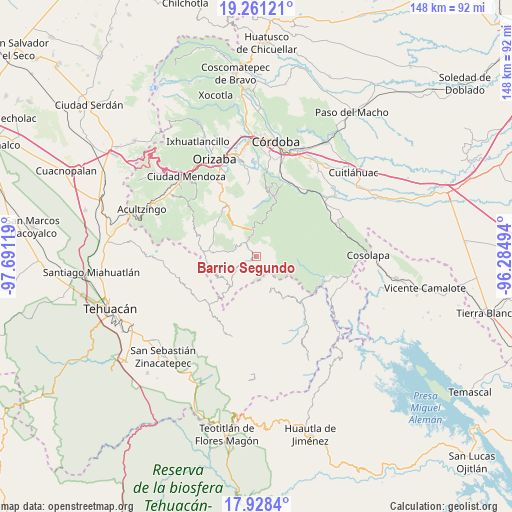
Barrio Segundo GPS coordinates[2]
18° 35' 45.996" North, 96° 59' 17.016" West
| Map corner | latitude | longitude |
|---|---|---|
| Upper-left | 19.26121°, | -97.69119° |
| Center: | 18.59611°, | -96.98806° |
| Lower-right: | 17.9284°, | -96.28494° |
| Map W x H: | 148.2×148.2 km | = 92.1×92.1mi |
| max Lat: | 32.7° ⇑71.5% North |
| Barrio Segundo: | 18.59611° |
| min Lat: | ⇓28.5% South 14.53588° |
| min Long | Barrio Segundo | max Long |
| -117.105° | -96.98806° | -86.73105° |
| W 75%⇐ | ⇒25% E |
Elevation
Elevation of Barrio Segundo is 1694 m = 5558 ft, and this is 440.3 m = 1445 ft above average elevation for this country.
| Max E: |
3497 m = 11473 ft | 41.8% |
| Barrio Segundo | 1694 m 5558 ft | |
| Avg. | 1253.7 m = 4113 ft | |
Min E: |
-1 m = -3 ft | 58.2% |
See also: Mexico elevation on elevation.city.
Geographical zone
Barrio Segundo is located in North Torrid zone (between Equator and Tropic of Cancer). Distance of this Northern Tropic circle is 538.2 km =334.4 mi to North.| Distance of | km | miles | from Barrio Segundo |
|---|---|---|---|
| North Pole | 7939.4 | 4933.3 | to North |
| Arctic Circle | 5333.5 | 3314.1 | to North |
| Tropic Cancer | 538.2 | 334.4 | to North |
| Equator | 2067.7 | 1284.8 | to South |


Nearby cities:
15 places around Barrio Segundo: (largest is in red/bold)
• Achichipico
6.1 km =3.8 mi,  192°
192°
• Barrio Cuarto
1.2 km =0.7 mi,  273°
273°
• Barrio Tercero
1.3 km =0.8 mi,  221°
221°
• Mixtla de Altamirano
0.5 km =0.3 mi, 267°
• Ocotempa (Barrio Primero)
1.1 km =0.7 mi,  315°
315°
• Opotzinga
5.1 km =3.2 mi,  204°
204°
• Papaloapan
8.7 km =5.4 mi,  139°
139°
• Tepenacaxtla
8.6 km =5.3 mi,  97°
97°
• Tepetitlanapa
5.9 km =3.7 mi,  332°
332°
• Tepetlampa
7.3 km =4.5 mi,  130°
130°
• Texhuacán
6.2 km =3.9 mi,  297°
297°
• Tlalca
6.6 km =4.1 mi, 295°
• Xochiojca
8.4 km =5.2 mi,  62°
62°
• Zapaltecatl
7.3 km =4.5 mi,  107°
107°
• Zongolica
7.9 km =4.9 mi,  353°
353°
Sources, notices
• [Note1] Compared only with cities in Mexico existing in our database
• [Src1] Map data: © OpenStreetMap contributors (CC-BY-SA)
• [Src2] Other city data from geonames.org with taken over terms of usage.
• [Src3] Geographical zone / Annual Mean Temperature by Robert A. Rohde @ Wikipedia
