Ejido la Piña (Maromilla) geodata
Ejido la Piña (Maromilla) (Veracruz) is a populated place; located in Mexico in America/Mexico_City (GMT-6) time zone. With population of 1,123 people, there are 7722 cities with bigger population in this country. Compared to other cities in Mexico, 64.2% of cities are located further ↑North; 77.5% of cities are located further ←West and 65.7% of cities have higher elevation than Ejido la Piña (Maromilla). Note1
Current local time in Ejido la Piña (Maromilla):
08:30 AM, WednesdayDifference from your time zone: hours


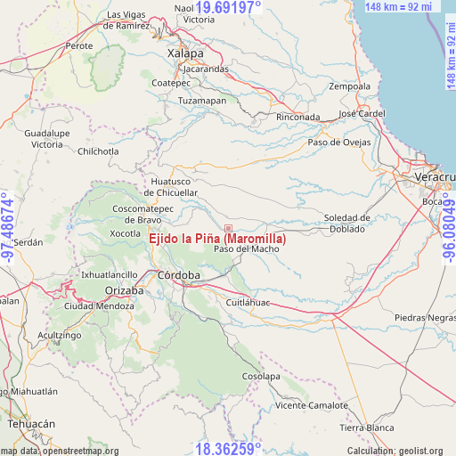
Ejido la Piña (Maromilla) GPS coordinates[2]
19° 1' 42.996" North, 96° 47' 0.996" West
| Map corner | latitude | longitude |
|---|---|---|
| Upper-left | 19.69197°, | -97.48674° |
| Center: | 19.02861°, | -96.78361° |
| Lower-right: | 18.36259°, | -96.08049° |
| Map W x H: | 147.8×147.8 km | = 91.8×91.8mi |
| max Lat: | 32.7° ⇑64.2% North |
| Ejido la Piña (Maromilla): | 19.02861° |
| min Lat: | ⇓35.8% South 14.53588° |
| min Long | Ejido la Piña | max Long |
| -117.105° | -96.78361° | -86.73105° |
| W 77.5%⇐ | ⇒22.5% E |
Elevation
Elevation of Ejido la Piña (Maromilla) is 649 m = 2129 ft, and this is 604.7 m = 1984 ft below average elevation for this country.
| Max E: |
3497 m = 11473 ft | 65.7% |
| Avg. | 1253.7 m = 4113 ft | |
| Ejido la Piña (Maromilla) | 649 m = 2129 ft | |
Min E: |
-1 m = -3 ft | 34.3% |
See also: Mexico elevation on elevation.city.
Geographical zone
Ejido la Piña (Maromilla) is located in North Torrid zone (between Equator and Tropic of Cancer). Distance of this Northern Tropic circle is 490.1 km =304.5 mi to North.| Distance of | km | miles | from Ejido la Piña (Maromilla) |
|---|---|---|---|
| North Pole | 7891.3 | 4903.4 | to North |
| Arctic Circle | 5285.4 | 3284.2 | to North |
| Tropic Cancer | 490.1 | 304.5 | to North |
| Equator | 2115.8 | 1314.7 | to South |


Nearby cities:
15 places around Ejido la Piña (Maromilla): (largest is in red/bold)
• Agua Escondida (El Olvido)
7.4 km =4.6 mi,  327°
327°
• Buena Vista
7.8 km =4.8 mi,  281°
281°
• Buenos Aires
9.8 km =6.1 mi,  169°
169°
• Cerro Azul
3.2 km =2 mi,  209°
209°
• Corazón de Jesús (Piña)
5.9 km =3.7 mi,  314°
314°
• La Charca
7.4 km =4.6 mi,  202°
202°
• La Palma
5 km =3.1 mi,  292°
292°
• Mata Naranjo
3.3 km =2.1 mi,  142°
142°
• Palo Gacho
2.6 km =1.6 mi,  266°
266°
• Paso del Macho
8.9 km =5.5 mi, 135°
• Progreso
5.8 km =3.6 mi,  235°
235°
• Pueblito de Matlaluca
4 km =2.5 mi,  354°
354°
• San José Tenejapa
6.4 km =4 mi,  256°
256°
• Tepatlaxco
7.9 km =4.9 mi, 305°
• Álvaro Obregón
9.3 km =5.8 mi, 255°
Sources, notices
• [Note1] Compared only with cities in Mexico existing in our database
• [Src1] Map data: © OpenStreetMap contributors (CC-BY-SA)
• [Src2] Other city data from geonames.org with taken over terms of usage.
• [Src3] Geographical zone / Annual Mean Temperature by Robert A. Rohde @ Wikipedia
