Rancho Viejo geodata
Rancho Viejo (Veracruz) is a populated place; located in Mexico in America/Mexico_City (GMT-6) time zone. With population of 885 people, there are 9853 cities with bigger population in this country. Compared to other cities in Mexico, 53.6% of cities are located further ↑North; 75.1% of cities are located further ←West and 50.4% of cities have lower elevation than Rancho Viejo. Note1


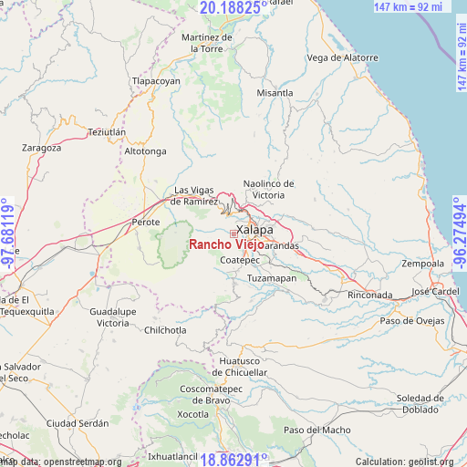
Rancho Viejo GPS coordinates[2]
19° 31' 36.984" North, 96° 58' 41.016" West
| Map corner | latitude | longitude |
|---|---|---|
| Upper-left | 20.18825°, | -97.68119° |
| Center: | 19.52694°, | -96.97806° |
| Lower-right: | 18.86291°, | -96.27494° |
| Map W x H: | 147.4×147.4 km | = 91.6×91.6mi |
| max Lat: | 32.7° ⇑53.6% North |
| Rancho Viejo: | 19.52694° |
| min Lat: | ⇓46.4% South 14.53588° |
| min Long | Rancho Viejo | max Long |
| -117.105° | -96.97806° | -86.73105° |
| W 75.1%⇐ | ⇒24.9% E |
Elevation
Elevation of Rancho Viejo is 1452 m = 4764 ft, and this is 198.3 m = 651 ft above average elevation for this country.
| Max E: |
3497 m = 11473 ft | 49.6% |
| Rancho Viejo | 1452 m 4764 ft | |
| Avg. | 1253.7 m = 4113 ft | |
Min E: |
-1 m = -3 ft | 50.4% |
See also: Mexico elevation on elevation.city.
Geographical zone
Rancho Viejo is located in North Torrid zone (between Equator and Tropic of Cancer). Distance of this Northern Tropic circle is 434.7 km =270.1 mi to North.| Distance of | km | miles | from Rancho Viejo |
|---|---|---|---|
| North Pole | 7835.9 | 4869 | to North |
| Arctic Circle | 5230 | 3249.8 | to North |
| Tropic Cancer | 434.7 | 270.1 | to North |
| Equator | 2171.2 | 1349.1 | to South |


Nearby cities:
15 places around Rancho Viejo: (largest is in red/bold)
• Carolino Anaya (Espina Blanca)
3.5 km =2.2 mi,  19°
19°
• Cañada Larga
1.4 km =0.9 mi,  4°
4°
• Cinco Palos
3.4 km =2.1 mi,  201°
201°
• Cuauhtémoc
3.9 km =2.4 mi,  179°
179°
• Guadalupe Victoria
3.6 km =2.2 mi,  30°
30°
• La Laguna
6.8 km =4.2 mi,  136°
136°
• Mariano Escobedo
4.8 km =3 mi,  133°
133°
• Mazatepec
6.6 km =4.1 mi,  320°
320°
• Naranjillos
2.2 km =1.4 mi, 3°
• Otilpan
3.4 km =2.1 mi, 2°
• Piletas
6.8 km =4.2 mi,  359°
359°
• Potrero del Bordo (Santa María)
1.3 km =0.8 mi, 19°
• San Antonio Hidalgo
1.7 km =1.1 mi, 20°
• Tlalnelhuayocan
4.4 km =2.7 mi, 3°
• Xalapa de Enríquez
6.5 km =4 mi,  85°
85°
Sources, notices
• [Note1] Compared only with cities in Mexico existing in our database
• [Src1] Map data: © OpenStreetMap contributors (CC-BY-SA)
• [Src2] Other city data from geonames.org with taken over terms of usage.
• [Src3] Geographical zone / Annual Mean Temperature by Robert A. Rohde @ Wikipedia
