Mariano Escobedo geodata
Mariano Escobedo (Veracruz) is a populated place; located in Mexico in America/Mexico_City (GMT-6) time zone. With population of 561 people, there are 15205 cities with bigger population in this country. Compared to other cities in Mexico, 54.1% of cities are located further ↑North; 75.6% of cities are located further ←West and 53.3% of cities have higher elevation than Mariano Escobedo. Note1


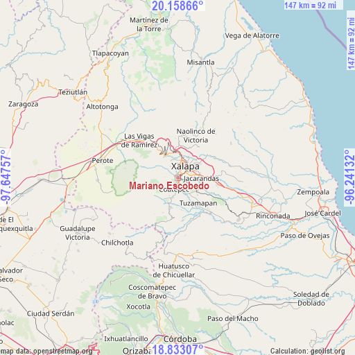
Mariano Escobedo GPS coordinates[2]
19° 29' 49.992" North, 96° 56' 39.984" West
| Map corner | latitude | longitude |
|---|---|---|
| Upper-left | 20.15866°, | -97.64757° |
| Center: | 19.49722°, | -96.94444° |
| Lower-right: | 18.83307°, | -96.24132° |
| Map W x H: | 147.4×147.4 km | = 91.6×91.6mi |
| max Lat: | 32.7° ⇑54.1% North |
| Mariano Escobedo: | 19.49722° |
| min Lat: | ⇓45.9% South 14.53588° |
| min Long | Mariano Escobed | max Long |
| -117.105° | -96.94444° | -86.73105° |
| W 75.6%⇐ | ⇒24.4% E |
Elevation
Elevation of Mariano Escobedo is 1277 m = 4190 ft, and this is 23.3 m = 76 ft above average elevation for this country.
| Max E: |
3497 m = 11473 ft | 53.3% |
| Mariano Escobedo | 1277 m 4190 ft | |
| Avg. | 1253.7 m = 4113 ft | |
Min E: |
-1 m = -3 ft | 46.7% |
See also: Mexico elevation on elevation.city.
Geographical zone
Mariano Escobedo is located in North Torrid zone (between Equator and Tropic of Cancer). Distance of this Northern Tropic circle is 438 km =272.2 mi to North.| Distance of | km | miles | from Mariano Escobedo |
|---|---|---|---|
| North Pole | 7839.2 | 4871.1 | to North |
| Arctic Circle | 5233.3 | 3251.8 | to North |
| Tropic Cancer | 438 | 272.2 | to North |
| Equator | 2167.9 | 1347.1 | to South |


Nearby cities:
15 places around Mariano Escobedo: (largest is in red/bold)
• Cañada Larga
5.8 km =3.6 mi,  324°
324°
• Cinco Palos
4.7 km =2.9 mi,  271°
271°
• Coatepec
5.3 km =3.3 mi,  199°
199°
• Cuauhtémoc
3.5 km =2.2 mi,  260°
260°
• Fraccionamiento las Fuentes
6.1 km =3.8 mi,  91°
91°
• Guadalupe Victoria
6.6 km =4.1 mi,  345°
345°
• La Laguna
2 km =1.2 mi,  146°
146°
• La Orduña
5.2 km =3.2 mi,  170°
170°
• Lomas Verdes
5.9 km =3.7 mi,  82°
82°
• Naranjillos
6.4 km =4 mi,  328°
328°
• Pacho Viejo
3.4 km =2.1 mi,  119°
119°
• Potrero del Bordo (Santa María)
5.5 km =3.4 mi, 325°
• Rancho Viejo
4.8 km =3 mi,  313°
313°
• San Antonio Hidalgo
5.7 km =3.5 mi, 329°
• Xalapa de Enríquez
4.8 km =3 mi,  38°
38°
Sources, notices
• [Note1] Compared only with cities in Mexico existing in our database
• [Src1] Map data: © OpenStreetMap contributors (CC-BY-SA)
• [Src2] Other city data from geonames.org with taken over terms of usage.
• [Src3] Geographical zone / Annual Mean Temperature by Robert A. Rohde @ Wikipedia
