San Juan Bautista Coapala geodata
San Juan Bautista Coapala (Guerrero) is a populated place; located in Mexico in America/Mexico_City (GMT-6) time zone. With population of 864 people, there are 10127 cities with bigger population in this country. Compared to other cities in Mexico, 83.7% of cities are located further ↑North; 53% of cities are located further ←West and 78.2% of cities have lower elevation than San Juan Bautista Coapala. Note1
Current local time in San Juan Bautista Coapala:
11:17 AM, MondayDifference from your time zone: hours


San Juan Bautista Coapala GPS coordinates[2]
17° 26' 29.004" North, 98° 50' 21.984" West
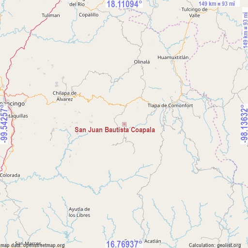
| Map corner | latitude | longitude |
|---|---|---|
| Upper-left | 18.11094°, | -99.54257° |
| Center: | 17.44139°, | -98.83944° |
| Lower-right: | 16.76937°, | -98.13632° |
| Map W x H: | 149.2×149.2 km | = 92.7×92.7mi |
| max Lat: | 32.7° ⇑83.7% North |
| San Juan Bautista Coapala: | 17.44139° |
| min Lat: | ⇓16.3% South 14.53588° |
| min Long | San Juan Bautis | max Long |
| -117.105° | -98.83944° | -86.73105° |
| W 53%⇐ | ⇒47% E |
Elevation
Elevation of San Juan Bautista Coapala is 2092 m = 6864 ft, and this is 838.3 m = 2750 ft above average elevation for this country.
| Max E: |
3497 m = 11473 ft | 21.8% |
| San Juan Bautista Coapala | 2092 m 6864 ft | |
| Avg. | 1253.7 m = 4113 ft | |
Min E: |
-1 m = -3 ft | 78.2% |
See also: Mexico elevation on elevation.city.
Geographical zone
San Juan Bautista Coapala is located in North Torrid zone (between Equator and Tropic of Cancer). Distance of this Northern Tropic circle is 666.6 km =414.2 mi to North.| Distance of | km | miles | from San Juan Bautista Coapala |
|---|---|---|---|
| North Pole | 8067.8 | 5013.1 | to North |
| Arctic Circle | 5461.9 | 3393.9 | to North |
| Tropic Cancer | 666.6 | 414.2 | to North |
| Equator | 1939.3 | 1205 | to South |


Nearby cities:
15 places around San Juan Bautista Coapala: (largest is in red/bold)
• Ahuixotitla
6.6 km =4.1 mi,  145°
145°
• Ayotoxtla
5.3 km =3.3 mi,  175°
175°
• Cacahuatepec
12.1 km =7.5 mi,  39°
39°
• Cacalotepec
8 km =5 mi,  218°
218°
• El Chirimoyo
12.1 km =7.5 mi,  205°
205°
• Escalerilla Lagunas
7.1 km =4.4 mi,  186°
186°
• Huixolotepec (Huitzolotepec)
10.9 km =6.8 mi, 221°
• Huiztlatzala
9.1 km =5.7 mi,  125°
125°
• Loma Tuza
10.3 km =6.4 mi,  197°
197°
• San Pedro Huitzapula Norte (Huitzapula Norte)
3.9 km =2.4 mi,  115°
115°
• Tamaloya
7 km =4.3 mi,  166°
166°
• Tlatlauquitepec
12 km =7.5 mi,  6°
6°
• Villa de Guadalupe
5.1 km =3.2 mi, 175°
• Xalpitzáhuac
4.4 km =2.7 mi,  245°
245°
• Zapotitlán Tablas
6.5 km =4 mi,  107°
107°
Sources, notices
• [Note1] Compared only with cities in Mexico existing in our database
• [Src1] Map data: © OpenStreetMap contributors (CC-BY-SA)
• [Src2] Other city data from geonames.org with taken over terms of usage.
• [Src3] Geographical zone / Annual Mean Temperature by Robert A. Rohde @ Wikipedia
