San Baltazar geodata
San Baltazar (Puebla) is a populated place; located in Mexico in America/Mexico_City (GMT-6) time zone. With population of 858 people, there are 10191 cities with bigger population in this country. Compared to other cities in Mexico, 68.9% of cities are located further ↑North; 66.6% of cities are located further ←West and 73.1% of cities have lower elevation than San Baltazar. Note1


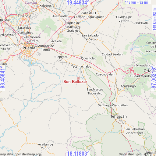
San Baltazar GPS coordinates[2]
18° 47' 6" North, 97° 45' 19.008" West
| Map corner | latitude | longitude |
|---|---|---|
| Upper-left | 19.44934°, | -98.45841° |
| Center: | 18.785°, | -97.75528° |
| Lower-right: | 18.11803°, | -97.05216° |
| Map W x H: | 148×148 km | = 92×92mi |
| max Lat: | 32.7° ⇑68.9% North |
| San Baltazar: | 18.785° |
| min Lat: | ⇓31.1% South 14.53588° |
| min Long | San Baltazar | max Long |
| -117.105° | -97.75528° | -86.73105° |
| W 66.6%⇐ | ⇒33.4% E |
Elevation
Elevation of San Baltazar is 1990 m = 6529 ft, and this is 736.3 m = 2416 ft above average elevation for this country.
| Max E: |
3497 m = 11473 ft | 26.9% |
| San Baltazar | 1990 m 6529 ft | |
| Avg. | 1253.7 m = 4113 ft | |
Min E: |
-1 m = -3 ft | 73.1% |
See also: Mexico elevation on elevation.city.
Geographical zone
San Baltazar is located in North Torrid zone (between Equator and Tropic of Cancer). Distance of this Northern Tropic circle is 517.2 km =321.4 mi to North.| Distance of | km | miles | from San Baltazar |
|---|---|---|---|
| North Pole | 7918.4 | 4920.3 | to North |
| Arctic Circle | 5312.5 | 3301 | to North |
| Tropic Cancer | 517.2 | 321.4 | to North |
| Equator | 2088.7 | 1297.9 | to South |


Nearby cities:
15 places around San Baltazar: (largest is in red/bold)
• Francisco Villa
6.7 km =4.2 mi,  352°
352°
• José María Pino Suárez
8.8 km =5.5 mi,  13°
13°
• La Laguna
2.5 km =1.6 mi,  50°
50°
• La Purísima
6.4 km =4 mi,  320°
320°
• La Soledad
2.9 km =1.8 mi,  341°
341°
• Ocotlán de Venustiano Carranza
9.1 km =5.7 mi,  85°
85°
• Rubén Jaramillo
5.4 km =3.4 mi,  1°
1°
• San Antonio Tecolco
7.8 km =4.8 mi, 342°
• San Antonio la Portilla
1.5 km =0.9 mi,  327°
327°
• San Gabriel Tetzoyocán
6.3 km =3.9 mi,  119°
119°
• Santiago Alseseca
8.4 km =5.2 mi,  37°
37°
• Tochtepec
9.3 km =5.8 mi,  310°
310°
• Veracrucito
8.6 km =5.3 mi, 329°
• Xochimilco
7 km =4.3 mi,  26°
26°
• Xochitlan Todos Santos
9.3 km =5.8 mi,  193°
193°
Sources, notices
• [Note1] Compared only with cities in Mexico existing in our database
• [Src1] Map data: © OpenStreetMap contributors (CC-BY-SA)
• [Src2] Other city data from geonames.org with taken over terms of usage.
• [Src3] Geographical zone / Annual Mean Temperature by Robert A. Rohde @ Wikipedia
