Santiago Alseseca geodata
Santiago Alseseca (Puebla) is a populated place; located in Mexico in America/Mexico_City (GMT-6) time zone. With population of 7,744 people, there are 1205 cities with bigger population in this country. Compared to other cities in Mexico, 68% of cities are located further ↑North; 67.1% of cities are located further ←West and 76.5% of cities have lower elevation than Santiago Alseseca. Note1


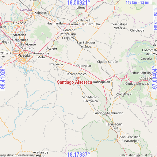
Santiago Alseseca GPS coordinates[2]
18° 50' 42.396" North, 97° 42' 25.776" West
| Map corner | latitude | longitude |
|---|---|---|
| Upper-left | 19.50921°, | -98.41029° |
| Center: | 18.84511°, | -97.70716° |
| Lower-right: | 18.17837°, | -97.00404° |
| Map W x H: | 148×148 km | = 92×92mi |
| max Lat: | 32.7° ⇑68% North |
| Santiago Alseseca: | 18.84511° |
| min Lat: | ⇓32% South 14.53588° |
| min Long | Santiago Alsese | max Long |
| -117.105° | -97.70716° | -86.73105° |
| W 67.1%⇐ | ⇒32.9% E |
Elevation
Elevation of Santiago Alseseca is 2058 m = 6752 ft, and this is 804.3 m = 2639 ft above average elevation for this country.
| Max E: |
3497 m = 11473 ft | 23.5% |
| Santiago Alseseca | 2058 m 6752 ft | |
| Avg. | 1253.7 m = 4113 ft | |
Min E: |
-1 m = -3 ft | 76.5% |
See also: Mexico elevation on elevation.city.
Geographical zone
Santiago Alseseca is located in North Torrid zone (between Equator and Tropic of Cancer). Distance of this Northern Tropic circle is 510.5 km =317.2 mi to North.| Distance of | km | miles | from Santiago Alseseca |
|---|---|---|---|
| North Pole | 7911.7 | 4916.1 | to North |
| Arctic Circle | 5305.8 | 3296.9 | to North |
| Tropic Cancer | 510.5 | 317.2 | to North |
| Equator | 2095.4 | 1302 | to South |


Nearby cities:
15 places around Santiago Alseseca: (largest is in red/bold)
• Francisco Villa
5.9 km =3.7 mi,  269°
269°
• José María Pino Suárez
3.5 km =2.2 mi,  302°
302°
• La Laguna
6 km =3.7 mi,  211°
211°
• La Soledad
7.2 km =4.5 mi,  236°
236°
• Lomas de Romero
7.8 km =4.8 mi,  352°
352°
• Ocotlán de Venustiano Carranza
7.2 km =4.5 mi,  146°
146°
• Rubén Jaramillo
5.1 km =3.2 mi,  255°
255°
• San Antonio Tecolco
7.5 km =4.7 mi,  276°
276°
• San Antonio la Portilla
8 km =5 mi,  227°
227°
• San Baltazar
8.4 km =5.2 mi,  217°
217°
• Tecamachalco
5.1 km =3.2 mi,  327°
327°
• Tlaixpan
8.1 km =5 mi,  336°
336°
• Tuzuapan
7.5 km =4.7 mi,  34°
34°
• Xochimilco
2 km =1.2 mi, 258°
• Yehualtepec
7.3 km =4.5 mi,  139°
139°
Sources, notices
• [Note1] Compared only with cities in Mexico existing in our database
• [Src1] Map data: © OpenStreetMap contributors (CC-BY-SA)
• [Src2] Other city data from geonames.org with taken over terms of usage.
• [Src3] Geographical zone / Annual Mean Temperature by Robert A. Rohde @ Wikipedia
