La Laguna geodata
La Laguna (Puebla) is a populated place; located in Mexico in America/Mexico_City (GMT-6) time zone. With population of 1,438 people, there are 6005 cities with bigger population in this country. Compared to other cities in Mexico, 68.7% of cities are located further ↑North; 66.8% of cities are located further ←West and 72.3% of cities have lower elevation than La Laguna. Note1


La Laguna GPS coordinates[2]
18° 47' 57.984" North, 97° 44' 12.012" West
| Map corner | latitude | longitude |
|---|---|---|
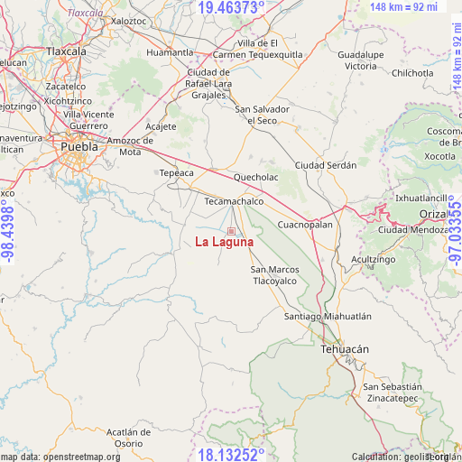
| Upper-left | 19.46373°, | -98.4398° |
| Center: | 18.79944°, | -97.73667° |
| Lower-right: | 18.13252°, | -97.03355° |
| Map W x H: | 148×148 km | = 92×92mi |
| max Lat: | 32.7° ⇑68.7% North |
| La Laguna: | 18.79944° |
| min Lat: | ⇓31.3% South 14.53588° |
| min Long | La Laguna | max Long |
| -117.105° | -97.73667° | -86.73105° |
| W 66.8%⇐ | ⇒33.2% E |
Elevation
Elevation of La Laguna is 1973 m = 6473 ft, and this is 719.3 m = 2360 ft above average elevation for this country.
| Max E: |
3497 m = 11473 ft | 27.7% |
| La Laguna | 1973 m 6473 ft | |
| Avg. | 1253.7 m = 4113 ft | |
Min E: |
-1 m = -3 ft | 72.3% |
See also: Mexico elevation on elevation.city.
Geographical zone
La Laguna is located in North Torrid zone (between Equator and Tropic of Cancer). Distance of this Northern Tropic circle is 515.6 km =320.4 mi to North.| Distance of | km | miles | from La Laguna |
|---|---|---|---|
| North Pole | 7916.8 | 4919.3 | to North |
| Arctic Circle | 5310.9 | 3300 | to North |
| Tropic Cancer | 515.6 | 320.4 | to North |
| Equator | 2090.3 | 1298.9 | to South |


Nearby cities:
15 places around La Laguna: (largest is in red/bold)
• Francisco Villa
5.7 km =3.5 mi,  330°
330°
• José María Pino Suárez
7 km =4.3 mi,  1°
1°
• La Purísima
6.9 km =4.3 mi,  298°
298°
• La Soledad
3.1 km =1.9 mi,  292°
292°
• Ocotlán de Venustiano Carranza
7.2 km =4.5 mi,  97°
97°
• Rubén Jaramillo
4.2 km =2.6 mi, 334°
• San Antonio Tecolco
7.3 km =4.5 mi,  323°
323°
• San Antonio la Portilla
2.8 km =1.7 mi,  262°
262°
• San Baltazar
2.5 km =1.6 mi,  230°
230°
• San Gabriel Tetzoyocán
5.9 km =3.7 mi,  143°
143°
• Santiago Alseseca
6 km =3.7 mi,  31°
31°
• Tecamachalco
9.4 km =5.8 mi, 2°
• Veracrucito
8.5 km =5.3 mi,  312°
312°
• Xochimilco
4.8 km =3 mi,  13°
13°
• Yehualtepec
7.9 km =4.9 mi,  93°
93°
Sources, notices
• [Note1] Compared only with cities in Mexico existing in our database
• [Src1] Map data: © OpenStreetMap contributors (CC-BY-SA)
• [Src2] Other city data from geonames.org with taken over terms of usage.
• [Src3] Geographical zone / Annual Mean Temperature by Robert A. Rohde @ Wikipedia
