San Gabriel Tetzoyocán geodata
San Gabriel Tetzoyocán (Puebla) is a populated place; located in Mexico in America/Mexico_City (GMT-6) time zone. With population of 6,060 people, there are 1543 cities with bigger population in this country. Compared to other cities in Mexico, 69.4% of cities are located further ↑North; 67.2% of cities are located further ←West and 74% of cities have lower elevation than San Gabriel Tetzoyocán. Note1


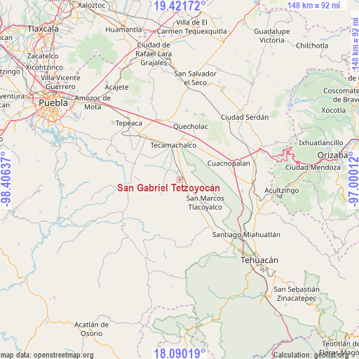
San Gabriel Tetzoyocán GPS coordinates[2]
18° 45' 26.172" North, 97° 42' 11.664" West
| Map corner | latitude | longitude |
|---|---|---|
| Upper-left | 19.42172°, | -98.40637° |
| Center: | 18.75727°, | -97.70324° |
| Lower-right: | 18.09019°, | -97.00012° |
| Map W x H: | 148.1×148.1 km | = 92×92mi |
| max Lat: | 32.7° ⇑69.4% North |
| San Gabriel Tetzoyocán: | 18.75727° |
| min Lat: | ⇓30.6% South 14.53588° |
| min Long | San Gabriel Tet | max Long |
| -117.105° | -97.70324° | -86.73105° |
| W 67.2%⇐ | ⇒32.8% E |
Elevation
Elevation of San Gabriel Tetzoyocán is 2012 m = 6601 ft, and this is 758.3 m = 2488 ft above average elevation for this country.
| Max E: |
3497 m = 11473 ft | 26% |
| San Gabriel Tetzoyocán | 2012 m 6601 ft | |
| Avg. | 1253.7 m = 4113 ft | |
Min E: |
-1 m = -3 ft | 74% |
See also: Mexico elevation on elevation.city.
Geographical zone
San Gabriel Tetzoyocán is located in North Torrid zone (between Equator and Tropic of Cancer). Distance of this Northern Tropic circle is 520.3 km =323.3 mi to North.| Distance of | km | miles | from San Gabriel Tetzoyocán |
|---|---|---|---|
| North Pole | 7921.4 | 4922.1 | to North |
| Arctic Circle | 5315.6 | 3303 | to North |
| Tropic Cancer | 520.3 | 323.3 | to North |
| Equator | 2085.6 | 1295.9 | to South |


Nearby cities:
15 places around San Gabriel Tetzoyocán: (largest is in red/bold)
• La Laguna
5.9 km =3.7 mi,  323°
323°
• La Soledad
8.7 km =5.4 mi,  312°
312°
• Los Marías
5.9 km =3.7 mi,  132°
132°
• Ocotlán de Venustiano Carranza
5.2 km =3.2 mi,  43°
43°
• Rancho Chico
4.2 km =2.6 mi,  106°
106°
• San Antonio la Portilla
7.6 km =4.7 mi,  304°
304°
• San Baltazar
6.3 km =3.9 mi, 299°
• San Lucas el Viejo
9 km =5.6 mi,  190°
190°
• San Miguel Zozutla
5.1 km =3.2 mi,  93°
93°
• Santo Nombre
9.7 km =6 mi,  162°
162°
• Tecalzingo
5.9 km =3.7 mi,  146°
146°
• Tepazolco
6.4 km =4 mi,  173°
173°
• Tlacomulco
5.5 km =3.4 mi, 114°
• Tlacotepec
9.7 km =6 mi, 149°
• Yehualtepec
6.1 km =3.8 mi,  46°
46°
Sources, notices
• [Note1] Compared only with cities in Mexico existing in our database
• [Src1] Map data: © OpenStreetMap contributors (CC-BY-SA)
• [Src2] Other city data from geonames.org with taken over terms of usage.
• [Src3] Geographical zone / Annual Mean Temperature by Robert A. Rohde @ Wikipedia
