San Antonio la Portilla geodata
San Antonio la Portilla (Puebla) is a populated place; located in Mexico in America/Mexico_City (GMT-6) time zone. With population of 1,870 people, there are 4643 cities with bigger population in this country. Compared to other cities in Mexico, 68.8% of cities are located further ↑North; 66.6% of cities are located further ←West and 72.2% of cities have lower elevation than San Antonio la Portilla. Note1
Current local time in San Antonio la Portilla:
10:02 AM, MondayDifference from your time zone: hours


San Antonio la Portilla GPS coordinates[2]
18° 47' 45.996" North, 97° 45' 46.008" West
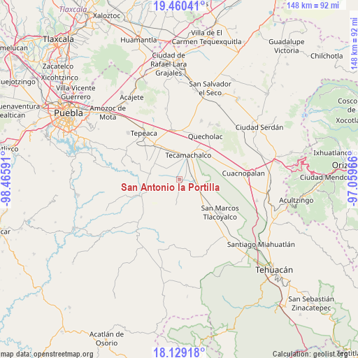
| Map corner | latitude | longitude |
|---|---|---|
| Upper-left | 19.46041°, | -98.46591° |
| Center: | 18.79611°, | -97.76278° |
| Lower-right: | 18.12918°, | -97.05966° |
| Map W x H: | 148×148 km | = 92×92mi |
| max Lat: | 32.7° ⇑68.8% North |
| San Antonio la Portilla: | 18.79611° |
| min Lat: | ⇓31.2% South 14.53588° |
| min Long | San Antonio la | max Long |
| -117.105° | -97.76278° | -86.73105° |
| W 66.6%⇐ | ⇒33.4% E |
Elevation
Elevation of San Antonio la Portilla is 1970 m = 6463 ft, and this is 716.3 m = 2350 ft above average elevation for this country.
| Max E: |
3497 m = 11473 ft | 27.8% |
| San Antonio la Portilla | 1970 m 6463 ft | |
| Avg. | 1253.7 m = 4113 ft | |
Min E: |
-1 m = -3 ft | 72.2% |
See also: Mexico elevation on elevation.city.
Geographical zone
San Antonio la Portilla is located in North Torrid zone (between Equator and Tropic of Cancer). Distance of this Northern Tropic circle is 516 km =320.6 mi to North.| Distance of | km | miles | from San Antonio la Portilla |
|---|---|---|---|
| North Pole | 7917.1 | 4919.5 | to North |
| Arctic Circle | 5311.2 | 3300.2 | to North |
| Tropic Cancer | 516 | 320.6 | to North |
| Equator | 2089.9 | 1298.6 | to South |


Nearby cities:
15 places around San Antonio la Portilla: (largest is in red/bold)
• Francisco Villa
5.4 km =3.4 mi,  359°
359°
• José María Pino Suárez
7.9 km =4.9 mi,  21°
21°
• La Laguna
2.8 km =1.7 mi,  82°
82°
• La Purísima
5 km =3.1 mi,  318°
318°
• La Soledad
1.6 km =1 mi,  354°
354°
• Ocotlán de Venustiano Carranza
9.9 km =6.2 mi,  93°
93°
• Rubén Jaramillo
4.3 km =2.7 mi,  12°
12°
• San Antonio Tecolco
6.4 km =4 mi, 345°
• San Baltazar
1.5 km =0.9 mi,  147°
147°
• San Gabriel Tetzoyocán
7.6 km =4.7 mi,  124°
124°
• Santa Rosa
9.2 km =5.7 mi, 347°
• Santiago Alseseca
8 km =5 mi,  47°
47°
• Tochtepec
7.9 km =4.9 mi,  307°
307°
• Veracrucito
7.1 km =4.4 mi,  330°
330°
• Xochimilco
6.4 km =4 mi,  37°
37°
Sources, notices
• [Note1] Compared only with cities in Mexico existing in our database
• [Src1] Map data: © OpenStreetMap contributors (CC-BY-SA)
• [Src2] Other city data from geonames.org with taken over terms of usage.
• [Src3] Geographical zone / Annual Mean Temperature by Robert A. Rohde @ Wikipedia
