La Luz geodata
La Luz (Michoacán) is a populated place; located in Mexico in America/Mexico_City (GMT-6) time zone. With population of 846 people, there are 10344 cities with bigger population in this country. Compared to other cities in Mexico, 59.9% of cities are located further ↓South; 80.3% of cities are located further →East and 57.8% of cities have lower elevation than La Luz. Note1


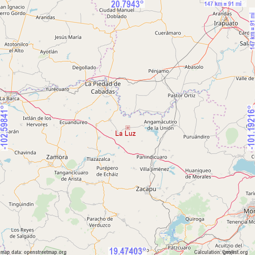
La Luz GPS coordinates[2]
20° 8' 8.016" North, 101° 53' 43.008" West
| Map corner | latitude | longitude |
|---|---|---|
| Upper-left | 20.7943°, | -102.59841° |
| Center: | 20.13556°, | -101.89528° |
| Lower-right: | 19.47403°, | -101.19216° |
| Map W x H: | 146.8×146.8 km | = 91.2×91.2mi |
| max Lat: | 32.7° ⇑40.1% North |
| La Luz: | 20.13556° |
| min Lat: | ⇓59.9% South 14.53588° |
| min Long | La Luz | max Long |
| -117.105° | -101.89528° | -86.73105° |
| W 19.7%⇐ | ⇒80.3% E |
Elevation
Elevation of La Luz is 1686 m = 5531 ft, and this is 432.3 m = 1418 ft above average elevation for this country.
| Max E: |
3497 m = 11473 ft | 42.2% |
| La Luz | 1686 m 5531 ft | |
| Avg. | 1253.7 m = 4113 ft | |
Min E: |
-1 m = -3 ft | 57.8% |
See also: Mexico elevation on elevation.city.
Geographical zone
La Luz is located in North Torrid zone (between Equator and Tropic of Cancer). Distance of this Northern Tropic circle is 367.1 km =228.1 mi to North.| Distance of | km | miles | from La Luz |
|---|---|---|---|
| North Pole | 7768.2 | 4826.9 | to North |
| Arctic Circle | 5162.3 | 3207.7 | to North |
| Tropic Cancer | 367.1 | 228.1 | to North |
| Equator | 2238.9 | 1391.2 | to South |


Nearby cities:
15 places around La Luz: (largest is in red/bold)
• Ansihuacuaro
11.7 km =7.3 mi,  52°
52°
• Cerritos Blancos
11.3 km =7 mi,  356°
356°
• Corrales de Rábago
9.5 km =5.9 mi,  23°
23°
• El Colorado
5.6 km =3.5 mi,  310°
310°
• El Palmito
10 km =6.2 mi,  328°
328°
• Guándaro
6.7 km =4.2 mi, 19°
• La Tepuza
6.3 km =3.9 mi, 330°
• Patambarillo
4.3 km =2.7 mi,  92°
92°
• Penjamillo de Degollado
5.4 km =3.4 mi,  229°
229°
• San José de Rábago
3.2 km =2 mi,  1°
1°
• San Miguel Epejan
11.3 km =7 mi,  132°
132°
• Santa Fe del Río
10.4 km =6.5 mi,  43°
43°
• Tirimácuaro (Valanciana)
3.5 km =2.2 mi,  201°
201°
• Zináparo
11.5 km =7.1 mi,  291°
291°
• Ziquítaro
8.2 km =5.1 mi,  176°
176°
Sources, notices
• [Note1] Compared only with cities in Mexico existing in our database
• [Src1] Map data: © OpenStreetMap contributors (CC-BY-SA)
• [Src2] Other city data from geonames.org with taken over terms of usage.
• [Src3] Geographical zone / Annual Mean Temperature by Robert A. Rohde @ Wikipedia
