Cañada de Ramírez geodata
Cañada de Ramírez (Michoacán) is a populated place; located in Mexico in America/Mexico_City (GMT-6) time zone. With population of 1,320 people, there are 6574 cities with bigger population in this country. Compared to other cities in Mexico, 63.4% of cities are located further ↓South; 80.7% of cities are located further →East and 58.7% of cities have lower elevation than Cañada de Ramírez. Note1


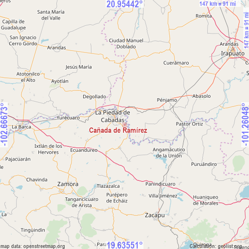
Cañada de Ramírez GPS coordinates[2]
20° 17' 46.932" North, 101° 57' 48.96" West
| Map corner | latitude | longitude |
|---|---|---|
| Upper-left | 20.95442°, | -102.66673° |
| Center: | 20.29637°, | -101.9636° |
| Lower-right: | 19.63551°, | -101.26048° |
| Map W x H: | 146.6×146.7 km | = 91.1×91.2mi |
| max Lat: | 32.7° ⇑36.6% North |
| Cañada de Ramírez: | 20.29637° |
| min Lat: | ⇓63.4% South 14.53588° |
| min Long | Cañada de Ram� | max Long |
| -117.105° | -101.9636° | -86.73105° |
| W 19.3%⇐ | ⇒80.7% E |
Elevation
Elevation of Cañada de Ramírez is 1703 m = 5587 ft, and this is 449.3 m = 1474 ft above average elevation for this country.
| Max E: |
3497 m = 11473 ft | 41.3% |
| Cañada de Ramírez | 1703 m 5587 ft | |
| Avg. | 1253.7 m = 4113 ft | |
Min E: |
-1 m = -3 ft | 58.7% |
See also: Mexico elevation on elevation.city.
Geographical zone
Cañada de Ramírez is located in North Torrid zone (between Equator and Tropic of Cancer). Distance of this Northern Tropic circle is 349.2 km =217 mi to North.| Distance of | km | miles | from Cañada de Ramírez |
|---|---|---|---|
| North Pole | 7750.3 | 4815.8 | to North |
| Arctic Circle | 5144.4 | 3196.6 | to North |
| Tropic Cancer | 349.2 | 217 | to North |
| Equator | 2256.7 | 1402.2 | to South |


Nearby cities:
15 places around Cañada de Ramírez: (largest is in red/bold)
• Estación la Piedad
8.7 km =5.4 mi,  335°
335°
• Guanajuatillo
5.8 km =3.6 mi,  320°
320°
• Guayabito de Pedroza
8.9 km =5.5 mi,  357°
357°
• La Cal Grande
5.6 km =3.5 mi,  21°
21°
• La Estancia del Refugio
3.3 km =2.1 mi,  90°
90°
• La Lobera
5.8 km =3.6 mi,  103°
103°
• La Piedad
8.7 km =5.4 mi,  306°
306°
• Lagunillas
7.1 km =4.4 mi,  74°
74°
• Las Cañadas
1.5 km =0.9 mi,  274°
274°
• Mezquite de Luna
7.4 km =4.6 mi, 88°
• Numarán
4.7 km =2.9 mi,  162°
162°
• Río Grande
6.9 km =4.3 mi, 320°
• Santa Ana Pacueco
7.9 km =4.9 mi, 316°
• Villas de las Lomas
2.7 km =1.7 mi, 274°
• Zaragoza
5.3 km =3.3 mi,  0°
0°
Sources, notices
• [Note1] Compared only with cities in Mexico existing in our database
• [Src1] Map data: © OpenStreetMap contributors (CC-BY-SA)
• [Src2] Other city data from geonames.org with taken over terms of usage.
• [Src3] Geographical zone / Annual Mean Temperature by Robert A. Rohde @ Wikipedia
