Las Raíces geodata
Las Raíces (Guanajuato) is a populated place; located in Mexico in America/Mexico_City (GMT-6) time zone. With population of 772 people, there are 11323 cities with bigger population in this country. Compared to other cities in Mexico, 64.7% of cities are located further ↓South; 76.8% of cities are located further →East and 58.5% of cities have lower elevation than Las Raíces. Note1


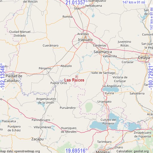
Las Raíces GPS coordinates[2]
20° 21' 20.772" North, 101° 25' 56.388" West
| Map corner | latitude | longitude |
|---|---|---|
| Upper-left | 21.01357°, | -102.13546° |
| Center: | 20.35577°, | -101.43233° |
| Lower-right: | 19.69516°, | -100.72921° |
| Map W x H: | 146.6×146.6 km | = 91.1×91.1mi |
| max Lat: | 32.7° ⇑35.3% North |
| Las Raíces: | 20.35577° |
| min Lat: | ⇓64.7% South 14.53588° |
| min Long | Las Raíces | max Long |
| -117.105° | -101.43233° | -86.73105° |
| W 23.2%⇐ | ⇒76.8% E |
Elevation
Elevation of Las Raíces is 1699 m = 5574 ft, and this is 445.3 m = 1461 ft above average elevation for this country.
| Max E: |
3497 m = 11473 ft | 41.5% |
| Las Raíces | 1699 m 5574 ft | |
| Avg. | 1253.7 m = 4113 ft | |
Min E: |
-1 m = -3 ft | 58.5% |
See also: Mexico elevation on elevation.city.
Geographical zone
Las Raíces is located in North Torrid zone (between Equator and Tropic of Cancer). Distance of this Northern Tropic circle is 342.6 km =212.9 mi to North.| Distance of | km | miles | from Las Raíces |
|---|---|---|---|
| North Pole | 7743.7 | 4811.7 | to North |
| Arctic Circle | 5137.8 | 3192.5 | to North |
| Tropic Cancer | 342.6 | 212.9 | to North |
| Equator | 2263.3 | 1406.3 | to South |


Nearby cities:
15 places around Las Raíces: (largest is in red/bold)
• Boquillas
6.7 km =4.2 mi,  359°
359°
• Charco de Pantoja
9 km =5.6 mi,  65°
65°
• Cora
4.6 km =2.9 mi,  233°
233°
• Guarapo
3.7 km =2.3 mi,  36°
36°
• Huanímaro
7 km =4.3 mi,  280°
280°
• Héroes de Chapultepec (Rodeo de San Antonio)
8.8 km =5.5 mi,  235°
235°
• Joroches (Joroches Nuevo)
8.5 km =5.3 mi,  250°
250°
• Labor de Peralta
6.4 km =4 mi,  22°
22°
• Las Cañas
6.8 km =4.2 mi,  167°
167°
• Los Martínez
7.4 km =4.6 mi,  142°
142°
• Otates
7.2 km =4.5 mi,  314°
314°
• Piedras Negras
9.3 km =5.8 mi,  27°
27°
• Salitre de Aguilares
4.4 km =2.7 mi,  195°
195°
• San Cristóbal
5.4 km =3.4 mi, 43°
• San José de Ayala
3.6 km =2.2 mi,  344°
344°
Sources, notices
• [Note1] Compared only with cities in Mexico existing in our database
• [Src1] Map data: © OpenStreetMap contributors (CC-BY-SA)
• [Src2] Other city data from geonames.org with taken over terms of usage.
• [Src3] Geographical zone / Annual Mean Temperature by Robert A. Rohde @ Wikipedia
