Rancho Nuevo geodata
Rancho Nuevo (Puebla) is a populated place; located in Mexico in America/Mexico_City (GMT-6) time zone. With population of 780 people, there are 11196 cities with bigger population in this country. Compared to other cities in Mexico, 61.6% of cities are located further ↑North; 74.2% of cities are located further ←West and 64.7% of cities have lower elevation than Rancho Nuevo. Note1


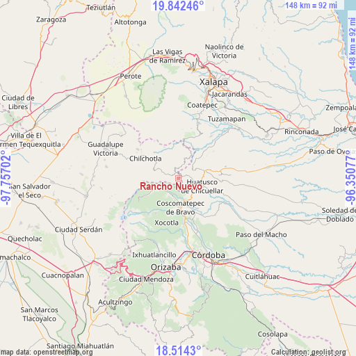
Rancho Nuevo GPS coordinates[2]
19° 10' 46.992" North, 97° 3' 14.004" West
| Map corner | latitude | longitude |
|---|---|---|
| Upper-left | 19.84246°, | -97.75702° |
| Center: | 19.17972°, | -97.05389° |
| Lower-right: | 18.5143°, | -96.35077° |
| Map W x H: | 147.7×147.7 km | = 91.8×91.8mi |
| max Lat: | 32.7° ⇑61.6% North |
| Rancho Nuevo: | 19.17972° |
| min Lat: | ⇓38.4% South 14.53588° |
| min Long | Rancho Nuevo | max Long |
| -117.105° | -97.05389° | -86.73105° |
| W 74.2%⇐ | ⇒25.8% E |
Elevation
Elevation of Rancho Nuevo is 1820 m = 5971 ft, and this is 566.3 m = 1858 ft above average elevation for this country.
| Max E: |
3497 m = 11473 ft | 35.3% |
| Rancho Nuevo | 1820 m 5971 ft | |
| Avg. | 1253.7 m = 4113 ft | |
Min E: |
-1 m = -3 ft | 64.7% |
See also: Mexico elevation on elevation.city.
Geographical zone
Rancho Nuevo is located in North Torrid zone (between Equator and Tropic of Cancer). Distance of this Northern Tropic circle is 473.3 km =294.1 mi to North.| Distance of | km | miles | from Rancho Nuevo |
|---|---|---|---|
| North Pole | 7874.5 | 4893 | to North |
| Arctic Circle | 5268.6 | 3273.8 | to North |
| Tropic Cancer | 473.3 | 294.1 | to North |
| Equator | 2132.6 | 1325.1 | to South |


Nearby cities:
15 places around Rancho Nuevo: (largest is in red/bold)
• Acalocotla
6 km =3.7 mi,  267°
267°
• Atlaxco
3.8 km =2.4 mi,  282°
282°
• Chalchitepec
3.3 km =2.1 mi,  140°
140°
• Chichiquila
2.7 km =1.7 mi,  329°
329°
• Dos Ríos
2.4 km =1.5 mi, 281°
• El Palmar
4.4 km =2.7 mi,  178°
178°
• El Progreso
1.8 km =1.1 mi,  163°
163°
• El Rosario
5.4 km =3.4 mi, 334°
• El Triunfo
6 km =3.7 mi,  17°
17°
• Elotepec
1.9 km =1.2 mi,  61°
61°
• Nenehuaca
4.2 km =2.6 mi, 162°
• Tepampa
5.3 km =3.3 mi, 141°
• Tizapa
2.3 km =1.4 mi,  250°
250°
• Xochimilco
6.1 km =3.8 mi,  299°
299°
• Xopanapa
6.4 km =4 mi,  293°
293°
Sources, notices
• [Note1] Compared only with cities in Mexico existing in our database
• [Src1] Map data: © OpenStreetMap contributors (CC-BY-SA)
• [Src2] Other city data from geonames.org with taken over terms of usage.
• [Src3] Geographical zone / Annual Mean Temperature by Robert A. Rohde @ Wikipedia
