Gabino Vázquez San Sebastián geodata
Gabino Vázquez San Sebastián (Chiapas) is a populated place; located in Mexico in America/Mexico_City (GMT-6) time zone. With population of 760 people, there are 11527 cities with bigger population in this country. Compared to other cities in Mexico, 95.3% of cities are located further ↑North; 95.5% of cities are located further ←West and 51.7% of cities have lower elevation than Gabino Vázquez San Sebastián. Note1
Current local time in Gabino Vázquez San Sebastián:
08:45 AM, MondayDifference from your time zone: hours


Gabino Vázquez San Sebastián GPS coordinates[2]
16° 21' 2.016" North, 91° 56' 13.992" West
| Map corner | latitude | longitude |
|---|---|---|
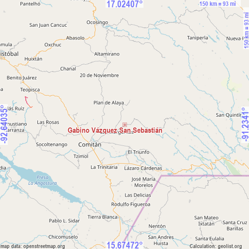
| Upper-left | 17.02407°, | -92.64035° |
| Center: | 16.35056°, | -91.93722° |
| Lower-right: | 15.67472°, | -91.2341° |
| Map W x H: | 150×150 km | = 93.2×93.2mi |
| max Lat: | 32.7° ⇑95.3% North |
| Gabino Vázquez San Sebastián: | 16.35056° |
| min Lat: | ⇓4.7% South 14.53588° |
| min Long | Gabino Vázquez | max Long |
| -117.105° | -91.93722° | -86.73105° |
| W 95.5%⇐ | ⇒4.5% E |
Elevation
Elevation of Gabino Vázquez San Sebastián is 1512 m = 4961 ft, and this is 258.3 m = 847 ft above average elevation for this country.
| Max E: |
3497 m = 11473 ft | 48.3% |
| Gabino Vázquez San Sebastián | 1512 m 4961 ft | |
| Avg. | 1253.7 m = 4113 ft | |
Min E: |
-1 m = -3 ft | 51.7% |
See also: Mexico elevation on elevation.city.
Geographical zone
Gabino Vázquez San Sebastián is located in North Torrid zone (between Equator and Tropic of Cancer). Distance of this Northern Tropic circle is 787.9 km =489.6 mi to North.| Distance of | km | miles | from Gabino Vázquez San Sebastián |
|---|---|---|---|
| North Pole | 8189.1 | 5088.5 | to North |
| Arctic Circle | 5583.2 | 3469.2 | to North |
| Tropic Cancer | 787.9 | 489.6 | to North |
| Equator | 1818 | 1129.7 | to South |


Nearby cities:
15 places around Gabino Vázquez San Sebastián: (largest is in red/bold)
• Belisario Domínguez
8.8 km =5.5 mi,  45°
45°
• El Campamento
6.4 km =4 mi,  206°
206°
• El Encanto
1.7 km =1.1 mi,  228°
228°
• El Progreso
5.4 km =3.4 mi,  168°
168°
• Espíritu Santo
4.1 km =2.5 mi,  238°
238°
• Francisco I. Madero
7 km =4.3 mi,  153°
153°
• Francisco Sarabia
11.8 km =7.3 mi,  193°
193°
• Ignacio Allende
6.9 km =4.3 mi,  122°
122°
• Ignacio Zaragoza
2 km =1.2 mi,  81°
81°
• Jalisco
9.7 km =6 mi,  335°
335°
• Las Margaritas
6.3 km =3.9 mi, 227°
• Saltillo
4.9 km =3 mi,  345°
345°
• San José las Palmas
8.4 km =5.2 mi,  257°
257°
• Veracruz
8.9 km =5.5 mi,  311°
311°
• Yalcoc
5.7 km =3.5 mi, 258°
Sources, notices
• [Note1] Compared only with cities in Mexico existing in our database
• [Src1] Map data: © OpenStreetMap contributors (CC-BY-SA)
• [Src2] Other city data from geonames.org with taken over terms of usage.
• [Src3] Geographical zone / Annual Mean Temperature by Robert A. Rohde @ Wikipedia
