Yalcoc geodata
Yalcoc (Chiapas) is a populated place; located in Mexico in America/Mexico_City (GMT-6) time zone. With population of 554 people, there are 15392 cities with bigger population in this country. Compared to other cities in Mexico, 95.4% of cities are located further ↑North; 95.3% of cities are located further ←West and 54.1% of cities have lower elevation than Yalcoc. Note1


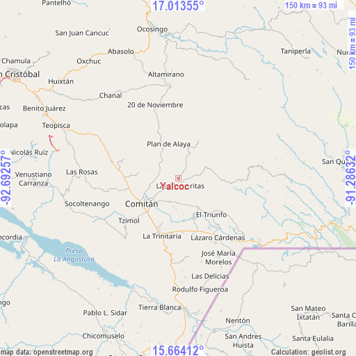
Yalcoc GPS coordinates[2]
16° 20' 24" North, 91° 59' 21.984" West
| Map corner | latitude | longitude |
|---|---|---|
| Upper-left | 17.01355°, | -92.69257° |
| Center: | 16.34°, | -91.98944° |
| Lower-right: | 15.66412°, | -91.28632° |
| Map W x H: | 150×150 km | = 93.2×93.2mi |
| max Lat: | 32.7° ⇑95.4% North |
| Yalcoc: | 16.34° |
| min Lat: | ⇓4.6% South 14.53588° |
| min Long | Yalcoc | max Long |
| -117.105° | -91.98944° | -86.73105° |
| W 95.3%⇐ | ⇒4.7% E |
Elevation
Elevation of Yalcoc is 1565 m = 5135 ft, and this is 311.3 m = 1021 ft above average elevation for this country.
| Max E: |
3497 m = 11473 ft | 45.9% |
| Yalcoc | 1565 m 5135 ft | |
| Avg. | 1253.7 m = 4113 ft | |
Min E: |
-1 m = -3 ft | 54.1% |
See also: Mexico elevation on elevation.city.
Geographical zone
Yalcoc is located in North Torrid zone (between Equator and Tropic of Cancer). Distance of this Northern Tropic circle is 789.1 km =490.3 mi to North.| Distance of | km | miles | from Yalcoc |
|---|---|---|---|
| North Pole | 8190.2 | 5089.2 | to North |
| Arctic Circle | 5584.3 | 3469.9 | to North |
| Tropic Cancer | 789.1 | 490.3 | to North |
| Equator | 1816.8 | 1128.9 | to South |


Nearby cities:
15 places around Yalcoc: (largest is in red/bold)
• El Campamento
5.3 km =3.3 mi,  149°
149°
• El Encanto
4.3 km =2.7 mi,  89°
89°
• El Progreso
7.9 km =4.9 mi,  121°
121°
• Espíritu Santo
2.3 km =1.4 mi,  113°
113°
• Francisco I. Madero
10 km =6.2 mi, 120°
• Gabino Vázquez San Sebastián
5.7 km =3.5 mi,  78°
78°
• Ignacio Zaragoza
7.7 km =4.8 mi, 79°
• Jalisco
10.2 km =6.3 mi,  8°
8°
• Las Margaritas
3.2 km =2 mi,  163°
163°
• Primero de Mayo
7.7 km =4.8 mi,  215°
215°
• Saltillo
7.4 km =4.6 mi,  35°
35°
• San José las Palmas
2.7 km =1.7 mi,  256°
256°
• Veracruz
7.2 km =4.5 mi,  351°
351°
• Villahermosa Yaluma
9.4 km =5.8 mi,  265°
265°
• Yasha
10.2 km =6.3 mi,  304°
304°
Sources, notices
• [Note1] Compared only with cities in Mexico existing in our database
• [Src1] Map data: © OpenStreetMap contributors (CC-BY-SA)
• [Src2] Other city data from geonames.org with taken over terms of usage.
• [Src3] Geographical zone / Annual Mean Temperature by Robert A. Rohde @ Wikipedia
