Tenextla geodata
Tenextla (Puebla) is a populated place; located in Mexico in America/Mexico_City (GMT-6) time zone. With population of 750 people, there are 11679 cities with bigger population in this country. Compared to other cities in Mexico, 53.6% of cities are located further ↓South; 63.5% of cities are located further ←West and 86.4% of cities have lower elevation than Tenextla. Note1


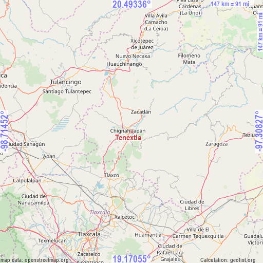
Tenextla GPS coordinates[2]
19° 49' 59.988" North, 98° 0' 41.004" West
| Map corner | latitude | longitude |
|---|---|---|
| Upper-left | 20.49336°, | -98.71452° |
| Center: | 19.83333°, | -98.01139° |
| Lower-right: | 19.17055°, | -97.30827° |
| Map W x H: | 147.1×147.1 km | = 91.4×91.4mi |
| max Lat: | 32.7° ⇑46.4% North |
| Tenextla: | 19.83333° |
| min Lat: | ⇓53.6% South 14.53588° |
| min Long | Tenextla | max Long |
| -117.105° | -98.01139° | -86.73105° |
| W 63.5%⇐ | ⇒36.5% E |
Elevation
Elevation of Tenextla is 2294 m = 7526 ft, and this is 1040.3 m = 3413 ft above average elevation for this country.
| Max E: |
3497 m = 11473 ft | 13.6% |
| Tenextla | 2294 m 7526 ft | |
| Avg. | 1253.7 m = 4113 ft | |
Min E: |
-1 m = -3 ft | 86.4% |
See also: Mexico elevation on elevation.city.
Geographical zone
Tenextla is located in North Torrid zone (between Equator and Tropic of Cancer). Distance of this Northern Tropic circle is 400.7 km =249 mi to North.| Distance of | km | miles | from Tenextla |
|---|---|---|---|
| North Pole | 7801.8 | 4847.8 | to North |
| Arctic Circle | 5195.9 | 3228.6 | to North |
| Tropic Cancer | 400.7 | 249 | to North |
| Equator | 2205.3 | 1370.3 | to South |


Nearby cities:
15 places around Tenextla: (largest is in red/bold)
• Aquixtla
9 km =5.6 mi,  117°
117°
• Atexcac
9.4 km =5.8 mi,  103°
103°
• Ayotla
10.2 km =6.3 mi,  343°
343°
• Chignahuapan
2.2 km =1.4 mi,  285°
285°
• Coacoyunga
2.8 km =1.7 mi,  220°
220°
• El Terrero
8.4 km =5.2 mi,  128°
128°
• Ixtlahuaca Barrio
0.7 km =0.4 mi,  332°
332°
• Loma Alta
4.3 km =2.7 mi,  202°
202°
• Lázaro Cárdenas (Tzitla)
4.8 km =3 mi,  246°
246°
• Matlahuacales Aquiles Serdán
9.1 km =5.7 mi,  209°
209°
• Michac
4.7 km =2.9 mi,  296°
296°
• San Pedro Atmatla
9.8 km =6.1 mi,  28°
28°
• Sebastopol
6.2 km =3.9 mi,  189°
189°
• Tepoxcuautla
7.8 km =4.8 mi,  5°
5°
• Tomatlán
7.8 km =4.8 mi, 30°
Sources, notices
• [Note1] Compared only with cities in Mexico existing in our database
• [Src1] Map data: © OpenStreetMap contributors (CC-BY-SA)
• [Src2] Other city data from geonames.org with taken over terms of usage.
• [Src3] Geographical zone / Annual Mean Temperature by Robert A. Rohde @ Wikipedia
