Chignahuapan geodata
Chignahuapan (Puebla) is a seat of a second-order administrative division; located in Mexico in America/Mexico_City (GMT-6) time zone. With population of 19,608 people, there are 509 cities with bigger population in this country. Compared to other cities in Mexico, 53.7% of cities are located further ↓South; 63.2% of cities are located further ←West and 86.4% of cities have lower elevation than Chignahuapan. Note1


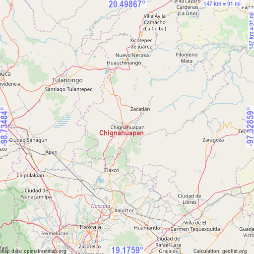
Chignahuapan GPS coordinates[2]
19° 50' 19.176" North, 98° 1' 54.156" West
| Map corner | latitude | longitude |
|---|---|---|
| Upper-left | 20.49867°, | -98.73484° |
| Center: | 19.83866°, | -98.03171° |
| Lower-right: | 19.1759°, | -97.32859° |
| Map W x H: | 147.1×147.1 km | = 91.4×91.4mi |
| max Lat: | 32.7° ⇑46.3% North |
| Chignahuapan: | 19.83866° |
| min Lat: | ⇓53.7% South 14.53588° |
| min Long | Chignahuapan | max Long |
| -117.105° | -98.03171° | -86.73105° |
| W 63.2%⇐ | ⇒36.8% E |
Elevation
Elevation of Chignahuapan is 2291 m = 7516 ft, and this is 1037.3 m = 3403 ft above average elevation for this country.
| Max E: |
3497 m = 11473 ft | 13.6% |
| Chignahuapan | 2291 m 7516 ft | |
| Avg. | 1253.7 m = 4113 ft | |
Min E: |
-1 m = -3 ft | 86.4% |
See also: Mexico elevation on elevation.city.
Geographical zone
Chignahuapan is located in North Torrid zone (between Equator and Tropic of Cancer). Distance of this Northern Tropic circle is 400.1 km =248.6 mi to North.| Distance of | km | miles | from Chignahuapan |
|---|---|---|---|
| North Pole | 7801.2 | 4847.4 | to North |
| Arctic Circle | 5195.3 | 3228.2 | to North |
| Tropic Cancer | 400.1 | 248.6 | to North |
| Equator | 2205.9 | 1370.7 | to South |


Nearby cities:
15 places around Chignahuapan: (largest is in red/bold)
• Ayotla
9.2 km =5.7 mi,  354°
354°
• Coacoyunga
2.8 km =1.7 mi,  174°
174°
• El Terrero
10.5 km =6.5 mi,  123°
123°
• Ixtlahuaca Barrio
1.8 km =1.1 mi,  89°
89°
• Loma Alta
4.6 km =2.9 mi, 174°
• Lázaro Cárdenas (Tzitla)
3.4 km =2.1 mi,  222°
222°
• Matlahuacales Aquiles Serdán
8.8 km =5.5 mi,  195°
195°
• Michac
2.6 km =1.6 mi,  306°
306°
• San Antonio Matlahuacales
10.7 km =6.6 mi,  209°
209°
• San Pedro Atmatla
10.5 km =6.5 mi,  39°
39°
• Sebastopol
6.8 km =4.2 mi, 170°
• Tenextla
2.2 km =1.4 mi,  105°
105°
• Tepoxcuautla
7.8 km =4.8 mi,  21°
21°
• Tomatlán
8.7 km =5.4 mi, 44°
• Villa Cuauhtémoc
9.6 km =6 mi,  225°
225°
Sources, notices
• [Note1] Compared only with cities in Mexico existing in our database
• [Src1] Map data: © OpenStreetMap contributors (CC-BY-SA)
• [Src2] Other city data from geonames.org with taken over terms of usage.
• [Src3] Geographical zone / Annual Mean Temperature by Robert A. Rohde @ Wikipedia
