Puente de Camotlán geodata
Puente de Camotlán (Jalisco) is a populated place; located in Mexico in America/Mexico_City (GMT-6) time zone. With population of 2,255 people, there are 3901 cities with bigger population in this country. Compared to other cities in Mexico, 82.4% of cities are located further ↓South; 90.2% of cities are located further →East and 56.5% of cities have higher elevation than Puente de Camotlán. Note1


Puente de Camotlán GPS coordinates[2]
21° 41' 55.32" North, 104° 4' 47.856" West
| Map corner | latitude | longitude |
|---|---|---|
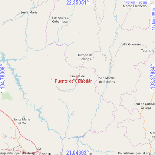
| Upper-left | 22.35051°, | -104.78309° |
| Center: | 21.6987°, | -104.07996° |
| Lower-right: | 21.04393°, | -103.37684° |
| Map W x H: | 145.3×145.3 km | = 90.3×90.3mi |
| max Lat: | 32.7° ⇑17.6% North |
| Puente de Camotlán: | 21.6987° |
| min Lat: | ⇓82.4% South 14.53588° |
| min Long | Puente de Camot | max Long |
| -117.105° | -104.07996° | -86.73105° |
| W 9.8%⇐ | ⇒90.2% E |
Elevation
Elevation of Puente de Camotlán is 1142 m = 3747 ft, and this is 111.7 m = 366 ft below average elevation for this country.
| Max E: |
3497 m = 11473 ft | 56.5% |
| Avg. | 1253.7 m = 4113 ft | |
| Puente de Camotlán | 1142 m = 3747 ft | |
Min E: |
-1 m = -3 ft | 43.5% |
See also: Mexico elevation on elevation.city.
Geographical zone
Puente de Camotlán is located in North Torrid zone (between Equator and Tropic of Cancer). Distance of this Northern Tropic circle is 193.2 km =120 mi to North.| Distance of | km | miles | from Puente de Camotlán |
|---|---|---|---|
| North Pole | 7594.4 | 4718.9 | to North |
| Arctic Circle | 4988.5 | 3099.7 | to North |
| Tropic Cancer | 193.2 | 120 | to North |
| Equator | 2412.7 | 1499.2 | to South |


Nearby cities:
15 places around Puente de Camotlán: (largest is in red/bold)
• Apozolco
34.8 km =21.6 mi,  149°
149°
• Bolaños
34.3 km =21.3 mi,  64°
64°
• Chimaltitán
32.2 km =20 mi,  73°
73°
• El Tepec
35.3 km =21.9 mi, 63°
• Huajimic
24.4 km =15.2 mi,  266°
266°
• Huaynamota
51.1 km =31.8 mi,  299°
299°
• La Mesa de Flores
57 km =35.4 mi,  181°
181°
• La Yesca
42.8 km =26.6 mi,  170°
170°
• Las Higueras
47.5 km =29.5 mi,  286°
286°
• Mesa del Tirador
4 km =2.5 mi,  20°
20°
• Naranjito de Copal
51 km =31.7 mi,  260°
260°
• San Martín de Bolaños
27.6 km =17.1 mi,  93°
93°
• San Miguel (San Miguel Huaixtita)
48.2 km =30 mi,  328°
328°
• Tepizuac
46.3 km =28.8 mi,  100°
100°
• Tuxpan de Bolaños
20.8 km =12.9 mi, 19°
Sources, notices
• [Note1] Compared only with cities in Mexico existing in our database
• [Src1] Map data: © OpenStreetMap contributors (CC-BY-SA)
• [Src2] Other city data from geonames.org with taken over terms of usage.
• [Src3] Geographical zone / Annual Mean Temperature by Robert A. Rohde @ Wikipedia
