Tepango geodata
Tepango (Guerrero) is a populated place; located in Mexico in America/Mexico_City (GMT-6) time zone. With population of 730 people, there are 11957 cities with bigger population in this country. Compared to other cities in Mexico, 90.3% of cities are located further ↑North; 50.9% of cities are located further →East and 72% of cities have higher elevation than Tepango. Note1


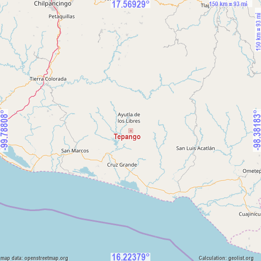
Tepango GPS coordinates[2]
16° 53' 51.864" North, 99° 5' 5.82" West
| Map corner | latitude | longitude |
|---|---|---|
| Upper-left | 17.56929°, | -99.78808° |
| Center: | 16.89774°, | -99.08495° |
| Lower-right: | 16.22379°, | -98.38183° |
| Map W x H: | 149.6×149.6 km | = 93×93mi |
| max Lat: | 32.7° ⇑90.3% North |
| Tepango: | 16.89774° |
| min Lat: | ⇓9.7% South 14.53588° |
| min Long | Tepango | max Long |
| -117.105° | -99.08495° | -86.73105° |
| W 49.1%⇐ | ⇒50.9% E |
Elevation
Elevation of Tepango is 328 m = 1076 ft, and this is 925.7 m = 3037 ft below average elevation for this country.
| Max E: |
3497 m = 11473 ft | 72% |
| Avg. | 1253.7 m = 4113 ft | |
| Tepango | 328 m = 1076 ft | |
Min E: |
-1 m = -3 ft | 28% |
See also: Mexico elevation on elevation.city.
Geographical zone
Tepango is located in North Torrid zone (between Equator and Tropic of Cancer). Distance of this Northern Tropic circle is 727.1 km =451.8 mi to North.| Distance of | km | miles | from Tepango |
|---|---|---|---|
| North Pole | 8128.2 | 5050.6 | to North |
| Arctic Circle | 5522.3 | 3431.4 | to North |
| Tropic Cancer | 727.1 | 451.8 | to North |
| Equator | 1878.9 | 1167.5 | to South |


Nearby cities:
15 places around Tepango: (largest is in red/bold)
• Ayutla de los Libres
7.4 km =4.6 mi,  350°
350°
• Cotzalzin
3.3 km =2.1 mi,  329°
329°
• El Cortijo
12.3 km =7.6 mi, 326°
• El Mesón
6.4 km =4 mi,  154°
154°
• El Paraíso
9.7 km =6 mi,  66°
66°
• El Zapote
6.9 km =4.3 mi,  187°
187°
• La Angostura
6.3 km =3.9 mi,  111°
111°
• La Azozuca
9.6 km =6 mi, 151°
• La Concordia
11.6 km =7.2 mi,  85°
85°
• La Unión
9.6 km =6 mi,  206°
206°
• Pozolapa
2.9 km =1.8 mi,  222°
222°
• San Antonio Abad
0.9 km =0.6 mi,  144°
144°
• San José la Hacienda
9.3 km =5.8 mi,  12°
12°
• Tonalá
5.2 km =3.2 mi, 141°
• Tutepec
8.1 km =5 mi,  289°
289°
Sources, notices
• [Note1] Compared only with cities in Mexico existing in our database
• [Src1] Map data: © OpenStreetMap contributors (CC-BY-SA)
• [Src2] Other city data from geonames.org with taken over terms of usage.
• [Src3] Geographical zone / Annual Mean Temperature by Robert A. Rohde @ Wikipedia
