Cuauhtémoc geodata
Cuauhtémoc (Chiapas) is a populated place; located in Mexico in America/Mexico_City (GMT-6) time zone. With population of 728 people, there are 11990 cities with bigger population in this country. Compared to other cities in Mexico, 81.3% of cities are located further ↑North; 94.8% of cities are located further ←West and 87.2% of cities have higher elevation than Cuauhtémoc. Note1


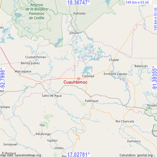
Cuauhtémoc GPS coordinates[2]
17° 41' 56.004" North, 92° 5' 48.012" West
| Map corner | latitude | longitude |
|---|---|---|
| Upper-left | 18.36747°, | -92.7998° |
| Center: | 17.69889°, | -92.09667° |
| Lower-right: | 17.02781°, | -91.39355° |
| Map W x H: | 149×149 km | = 92.6×92.6mi |
| max Lat: | 32.7° ⇑81.3% North |
| Cuauhtémoc: | 17.69889° |
| min Lat: | ⇓18.7% South 14.53588° |
| min Long | Cuauhtémoc | max Long |
| -117.105° | -92.09667° | -86.73105° |
| W 94.8%⇐ | ⇒5.2% E |
Elevation
Elevation of Cuauhtémoc is 33 m = 108 ft, and this is 1220.7 m = 4005 ft below average elevation for this country.
| Max E: |
3497 m = 11473 ft | 87.2% |
| Avg. | 1253.7 m = 4113 ft | |
| Cuauhtémoc | 33 m = 108 ft | |
Min E: |
-1 m = -3 ft | 12.8% |
See also: Mexico elevation on elevation.city.
Geographical zone
Cuauhtémoc is located in North Torrid zone (between Equator and Tropic of Cancer). Distance of this Northern Tropic circle is 638 km =396.4 mi to North.| Distance of | km | miles | from Cuauhtémoc |
|---|---|---|---|
| North Pole | 8039.1 | 4995.3 | to North |
| Arctic Circle | 5433.2 | 3376 | to North |
| Tropic Cancer | 638 | 396.4 | to North |
| Equator | 1967.9 | 1222.8 | to South |


Nearby cities:
15 places around Cuauhtémoc: (largest is in red/bold)
• Agua Fría
5.1 km =3.2 mi,  359°
359°
• Alcalde Mayor
22.8 km =14.2 mi,  274°
274°
• Aquiles Serdán
21.9 km =13.6 mi,  295°
295°
• Bajadas Grandes
17.5 km =10.9 mi, 270°
• Catazajá
9.3 km =5.8 mi,  72°
72°
• El Paraíso
11.8 km =7.3 mi,  28°
28°
• El Rosario
11.9 km =7.4 mi, 358°
• Emilio Rabasa
7.7 km =4.8 mi, 268°
• Ignacio Zaragoza
14.8 km =9.2 mi,  48°
48°
• Loma Bonita
10 km =6.2 mi,  12°
12°
• Punta Arena
6.6 km =4.1 mi,  37°
37°
• Ramón Grande
21.5 km =13.4 mi,  307°
307°
• Saturnino Ríos
13.1 km =8.1 mi,  231°
231°
• Tzeltal Mukul-Já
9.5 km =5.9 mi,  184°
184°
• Venustiano Carranza
17.7 km =11 mi, 299°
Sources, notices
• [Note1] Compared only with cities in Mexico existing in our database
• [Src1] Map data: © OpenStreetMap contributors (CC-BY-SA)
• [Src2] Other city data from geonames.org with taken over terms of usage.
• [Src3] Geographical zone / Annual Mean Temperature by Robert A. Rohde @ Wikipedia
