San José Ixtepec geodata
San José Ixtepec (Chiapas) is a populated place; located in Mexico in America/Mexico_City (GMT-6) time zone. With population of 642 people, there are 13481 cities with bigger population in this country. Compared to other cities in Mexico, 98.8% of cities are located further ↑North; 92.9% of cities are located further ←West and 69.5% of cities have lower elevation than San José Ixtepec. Note1


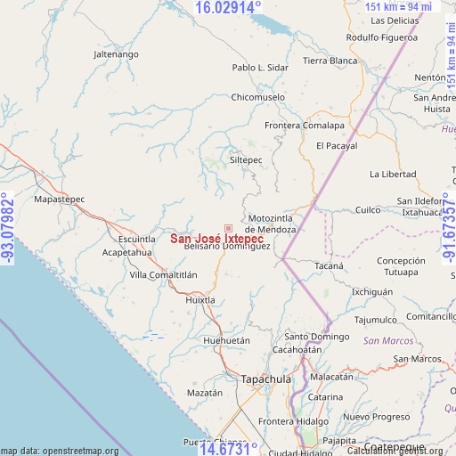
San José Ixtepec GPS coordinates[2]
15° 21' 7.992" North, 92° 22' 36.084" West
| Map corner | latitude | longitude |
|---|---|---|
| Upper-left | 16.02914°, | -93.07982° |
| Center: | 15.35222°, | -92.37669° |
| Lower-right: | 14.6731°, | -91.67357° |
| Map W x H: | 150.8×150.8 km | = 93.7×93.7mi |
| max Lat: | 32.7° ⇑98.8% North |
| San José Ixtepec: | 15.35222° |
| min Lat: | ⇓1.2% South 14.53588° |
| min Long | San José Ixtep | max Long |
| -117.105° | -92.37669° | -86.73105° |
| W 92.9%⇐ | ⇒7.1% E |
Elevation
Elevation of San José Ixtepec is 1916 m = 6286 ft, and this is 662.3 m = 2173 ft above average elevation for this country.
| Max E: |
3497 m = 11473 ft | 30.5% |
| San José Ixtepec | 1916 m 6286 ft | |
| Avg. | 1253.7 m = 4113 ft | |
Min E: |
-1 m = -3 ft | 69.5% |
See also: Mexico elevation on elevation.city.
Geographical zone
San José Ixtepec is located in North Torrid zone (between Equator and Tropic of Cancer). Distance of this Northern Tropic circle is 898.9 km =558.6 mi to North.| Distance of | km | miles | from San José Ixtepec |
|---|---|---|---|
| North Pole | 8300.1 | 5157.4 | to North |
| Arctic Circle | 5694.2 | 3538.2 | to North |
| Tropic Cancer | 898.9 | 558.6 | to North |
| Equator | 1707 | 1060.7 | to South |


Nearby cities:
15 places around San José Ixtepec: (largest is in red/bold)
• Belisario Domínguez
5.9 km =3.7 mi,  184°
184°
• Benito Juárez
7 km =4.3 mi,  76°
76°
• Berriozábal
14.3 km =8.9 mi,  135°
135°
• Bremen
15 km =9.3 mi,  168°
168°
• Buenavista
8.2 km =5.1 mi,  126°
126°
• Cambil
10.4 km =6.5 mi,  35°
35°
• Checute
15.2 km =9.4 mi, 130°
• El Carrizal
10 km =6.2 mi,  54°
54°
• El Tarral
15.2 km =9.4 mi, 183°
• Francisco I. Madero
4.8 km =3 mi,  257°
257°
• Las Salvias
13.5 km =8.4 mi,  34°
34°
• Llano Grande
11.9 km =7.4 mi,  146°
146°
• Miguel Alemán
4.6 km =2.9 mi,  287°
287°
• Motozintla
14.1 km =8.8 mi, 83°
• Nueva América
10.4 km =6.5 mi,  223°
223°
Sources, notices
• [Note1] Compared only with cities in Mexico existing in our database
• [Src1] Map data: © OpenStreetMap contributors (CC-BY-SA)
• [Src2] Other city data from geonames.org with taken over terms of usage.
• [Src3] Geographical zone / Annual Mean Temperature by Robert A. Rohde @ Wikipedia
