Barrio Guadalupe geodata
Barrio Guadalupe (Veracruz) is a populated place; located in Mexico in America/Mexico_City (GMT-6) time zone. With population of 580 people, there are 14779 cities with bigger population in this country. Compared to other cities in Mexico, 68.9% of cities are located further ↑North; 76.4% of cities are located further ←West and 66.8% of cities have higher elevation than Barrio Guadalupe. Note1


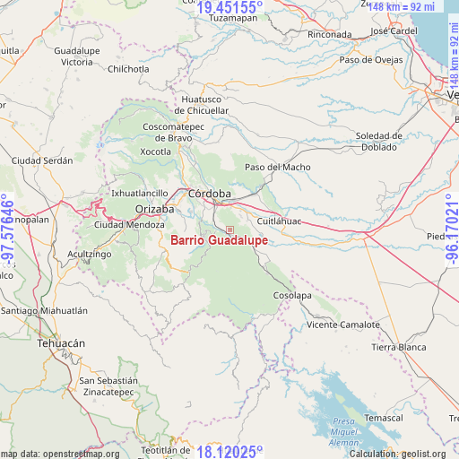
Barrio Guadalupe GPS coordinates[2]
18° 47' 13.992" North, 96° 52' 23.988" West
| Map corner | latitude | longitude |
|---|---|---|
| Upper-left | 19.45155°, | -97.57646° |
| Center: | 18.78722°, | -96.87333° |
| Lower-right: | 18.12025°, | -96.17021° |
| Map W x H: | 148×148 km | = 92×92mi |
| max Lat: | 32.7° ⇑68.9% North |
| Barrio Guadalupe: | 18.78722° |
| min Lat: | ⇓31.1% South 14.53588° |
| min Long | Barrio Guadalup | max Long |
| -117.105° | -96.87333° | -86.73105° |
| W 76.4%⇐ | ⇒23.6% E |
Elevation
Elevation of Barrio Guadalupe is 593 m = 1946 ft, and this is 660.7 m = 2168 ft below average elevation for this country.
| Max E: |
3497 m = 11473 ft | 66.8% |
| Avg. | 1253.7 m = 4113 ft | |
| Barrio Guadalupe | 593 m = 1946 ft | |
Min E: |
-1 m = -3 ft | 33.2% |
See also: Mexico elevation on elevation.city.
Geographical zone
Barrio Guadalupe is located in North Torrid zone (between Equator and Tropic of Cancer). Distance of this Northern Tropic circle is 517 km =321.2 mi to North.| Distance of | km | miles | from Barrio Guadalupe |
|---|---|---|---|
| North Pole | 7918.1 | 4920.1 | to North |
| Arctic Circle | 5312.2 | 3300.8 | to North |
| Tropic Cancer | 517 | 321.2 | to North |
| Equator | 2088.9 | 1298 | to South |


Nearby cities:
15 places around Barrio Guadalupe: (largest is in red/bold)
• Cacahuatal
5.9 km =3.7 mi,  34°
34°
• Coetzala
4.6 km =2.9 mi,  267°
267°
• Coetzapotitla
6.9 km =4.3 mi,  242°
242°
• Cuichapa
1.8 km =1.1 mi,  165°
165°
• El Otate
2.9 km =1.8 mi,  306°
306°
• General Juan José Baz (San José del Corral)
7 km =4.3 mi,  56°
56°
• Guadalupe
6.2 km =3.9 mi,  300°
300°
• La Loma de Guadalupe
6.3 km =3.9 mi, 61°
• Manuel León
7.4 km =4.6 mi,  1°
1°
• Rincón de Buena Vista
3.6 km =2.2 mi, 171°
• San Antonio Fraternidad
7.3 km =4.5 mi, 28°
• Tenejápam de Mata
1.9 km =1.2 mi,  205°
205°
• Tepecoxtla
7.9 km =4.9 mi,  147°
147°
• Venta Parada
7.6 km =4.7 mi,  19°
19°
• Xuchiles
6.3 km =3.9 mi,  119°
119°
Sources, notices
• [Note1] Compared only with cities in Mexico existing in our database
• [Src1] Map data: © OpenStreetMap contributors (CC-BY-SA)
• [Src2] Other city data from geonames.org with taken over terms of usage.
• [Src3] Geographical zone / Annual Mean Temperature by Robert A. Rohde @ Wikipedia
