Huitiupán geodata
Huitiupán (Chiapas) is a seat of a second-order administrative division; located in Mexico in America/Mexico_City (GMT-6) time zone. With population of 2,857 people, there are 3112 cities with bigger population in this country. Compared to other cities in Mexico, 86.8% of cities are located further ↑North; 90.6% of cities are located further ←West and 72.6% of cities have higher elevation than Huitiupán. Note1


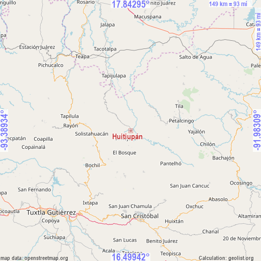
Huitiupán GPS coordinates[2]
17° 10' 20.64" North, 92° 41' 10.356" West
| Map corner | latitude | longitude |
|---|---|---|
| Upper-left | 17.84295°, | -93.38934° |
| Center: | 17.1724°, | -92.68621° |
| Lower-right: | 16.49942°, | -91.98309° |
| Map W x H: | 149.4×149.4 km | = 92.8×92.8mi |
| max Lat: | 32.7° ⇑86.8% North |
| Huitiupán: | 17.1724° |
| min Lat: | ⇓13.2% South 14.53588° |
| min Long | Huitiupán | max Long |
| -117.105° | -92.68621° | -86.73105° |
| W 90.6%⇐ | ⇒9.4% E |
Elevation
Elevation of Huitiupán is 306 m = 1004 ft, and this is 947.7 m = 3109 ft below average elevation for this country.
| Max E: |
3497 m = 11473 ft | 72.6% |
| Avg. | 1253.7 m = 4113 ft | |
| Huitiupán | 306 m = 1004 ft | |
Min E: |
-1 m = -3 ft | 27.4% |
See also: Mexico elevation on elevation.city.
Geographical zone
Huitiupán is located in North Torrid zone (between Equator and Tropic of Cancer). Distance of this Northern Tropic circle is 696.5 km =432.8 mi to North.| Distance of | km | miles | from Huitiupán |
|---|---|---|---|
| North Pole | 8097.7 | 5031.7 | to North |
| Arctic Circle | 5491.8 | 3412.4 | to North |
| Tropic Cancer | 696.5 | 432.8 | to North |
| Equator | 1909.4 | 1186.4 | to South |


Nearby cities:
15 places around Huitiupán: (largest is in red/bold)
• El Azufre
5.6 km =3.5 mi,  50°
50°
• El Jardín
9.3 km =5.8 mi,  94°
94°
• El Ocotal
7.7 km =4.8 mi,  294°
294°
• Emiliano Zapata
10.4 km =6.5 mi,  29°
29°
• Guadalupe Victoria Dos
8.4 km =5.2 mi,  264°
264°
• José María Morelos y Pavón
7.8 km =4.8 mi,  347°
347°
• La Competencia
10.3 km =6.4 mi,  313°
313°
• La Pimienta
8.8 km =5.5 mi,  246°
246°
• Las Limas
8.5 km =5.3 mi,  189°
189°
• Lázaro Cárdenas
11.2 km =7 mi,  60°
60°
• Natividad Pechuag
10.2 km =6.3 mi,  134°
134°
• Ramos Cubilete
9.7 km =6 mi,  2°
2°
• San Rafael
10.7 km =6.6 mi, 287°
• Simojovel de Allende
4.6 km =2.9 mi,  219°
219°
• Yuquín
10.3 km =6.4 mi, 215°
Sources, notices
• [Note1] Compared only with cities in Mexico existing in our database
• [Src1] Map data: © OpenStreetMap contributors (CC-BY-SA)
• [Src2] Other city data from geonames.org with taken over terms of usage.
• [Src3] Geographical zone / Annual Mean Temperature by Robert A. Rohde @ Wikipedia
