Camelia Roja geodata
Camelia Roja (Oaxaca) is a populated place; located in Mexico in America/Mexico_City (GMT-6) time zone. With population of 1,560 people, there are 5531 cities with bigger population in this country. Compared to other cities in Mexico, 78.3% of cities are located further ↑North; 81.4% of cities are located further ←West and 84.7% of cities have higher elevation than Camelia Roja. Note1


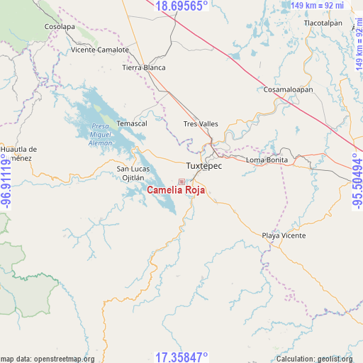
Camelia Roja GPS coordinates[2]
18° 1' 41.988" North, 96° 12' 29.016" West
| Map corner | latitude | longitude |
|---|---|---|
| Upper-left | 18.69565°, | -96.91119° |
| Center: | 18.02833°, | -96.20806° |
| Lower-right: | 17.35847°, | -95.50494° |
| Map W x H: | 148.7×148.7 km | = 92.4×92.4mi |
| max Lat: | 32.7° ⇑78.3% North |
| Camelia Roja: | 18.02833° |
| min Lat: | ⇓21.7% South 14.53588° |
| min Long | Camelia Roja | max Long |
| -117.105° | -96.20806° | -86.73105° |
| W 81.4%⇐ | ⇒18.6% E |
Elevation
Elevation of Camelia Roja is 46 m = 151 ft, and this is 1207.7 m = 3962 ft below average elevation for this country.
| Max E: |
3497 m = 11473 ft | 84.7% |
| Avg. | 1253.7 m = 4113 ft | |
| Camelia Roja | 46 m = 151 ft | |
Min E: |
-1 m = -3 ft | 15.3% |
See also: Mexico elevation on elevation.city.
Geographical zone
Camelia Roja is located in North Torrid zone (between Equator and Tropic of Cancer). Distance of this Northern Tropic circle is 601.4 km =373.7 mi to North.| Distance of | km | miles | from Camelia Roja |
|---|---|---|---|
| North Pole | 8002.5 | 4972.5 | to North |
| Arctic Circle | 5396.6 | 3353.3 | to North |
| Tropic Cancer | 601.4 | 373.7 | to North |
| Equator | 2004.6 | 1245.6 | to South |


Nearby cities:
15 places around Camelia Roja: (largest is in red/bold)
• Arroyo Choápam
8.4 km =5.2 mi,  140°
140°
• Arroyo Frijol
11.9 km =7.4 mi,  168°
168°
• El Camarón
9 km =5.6 mi,  3°
3°
• Fortino J. Pinacho
5.5 km =3.4 mi, 139°
• La Mina
12.3 km =7.6 mi,  111°
111°
• Macín Chico
8.1 km =5 mi,  303°
303°
• Mata de Caña
9.7 km =6 mi,  87°
87°
• Paso Canoa
3.6 km =2.2 mi,  241°
241°
• San Bartolo
12.8 km =8 mi,  56°
56°
• San Isidro
13.7 km =8.5 mi,  7°
7°
• San José Chiltepec
9.9 km =6.2 mi,  155°
155°
• Santa Ursula
3.7 km =2.3 mi,  230°
230°
• Sebastopol
3.8 km =2.4 mi,  81°
81°
• Soledad Macín Chico
3.7 km =2.3 mi,  339°
339°
• Tuxtepec
11 km =6.8 mi,  52°
52°
Sources, notices
• [Note1] Compared only with cities in Mexico existing in our database
• [Src1] Map data: © OpenStreetMap contributors (CC-BY-SA)
• [Src2] Other city data from geonames.org with taken over terms of usage.
• [Src3] Geographical zone / Annual Mean Temperature by Robert A. Rohde @ Wikipedia
