Paso Canoa geodata
Paso Canoa (Oaxaca) is a populated place; located in Mexico in America/Mexico_City (GMT-6) time zone. With population of 1,155 people, there are 7511 cities with bigger population in this country. Compared to other cities in Mexico, 78.5% of cities are located further ↑North; 81.1% of cities are located further ←West and 83.8% of cities have higher elevation than Paso Canoa. Note1


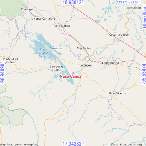
Paso Canoa GPS coordinates[2]
18° 0' 45.864" North, 96° 14' 16.296" West
| Map corner | latitude | longitude |
|---|---|---|
| Upper-left | 18.68012°, | -96.94099° |
| Center: | 18.01274°, | -96.23786° |
| Lower-right: | 17.34282°, | -95.53474° |
| Map W x H: | 148.7×148.7 km | = 92.4×92.4mi |
| max Lat: | 32.7° ⇑78.5% North |
| Paso Canoa: | 18.01274° |
| min Lat: | ⇓21.5% South 14.53588° |
| min Long | Paso Canoa | max Long |
| -117.105° | -96.23786° | -86.73105° |
| W 81.1%⇐ | ⇒18.9% E |
Elevation
Elevation of Paso Canoa is 53 m = 174 ft, and this is 1200.7 m = 3939 ft below average elevation for this country.
| Max E: |
3497 m = 11473 ft | 83.8% |
| Avg. | 1253.7 m = 4113 ft | |
| Paso Canoa | 53 m = 174 ft | |
Min E: |
-1 m = -3 ft | 16.2% |
See also: Mexico elevation on elevation.city.
Geographical zone
Paso Canoa is located in North Torrid zone (between Equator and Tropic of Cancer). Distance of this Northern Tropic circle is 603.1 km =374.7 mi to North.| Distance of | km | miles | from Paso Canoa |
|---|---|---|---|
| North Pole | 8004.2 | 4973.6 | to North |
| Arctic Circle | 5398.3 | 3354.3 | to North |
| Tropic Cancer | 603.1 | 374.7 | to North |
| Equator | 2002.8 | 1244.5 | to South |


Nearby cities:
15 places around Paso Canoa: (largest is in red/bold)
• Arroyo Choápam
9.7 km =6 mi,  118°
118°
• Arroyo Frijol
11.4 km =7.1 mi,  150°
150°
• Buenos Aires el Apompo
15.6 km =9.7 mi,  339°
339°
• Camelia Roja
3.6 km =2.2 mi,  61°
61°
• El Camarón
11.4 km =7.1 mi,  19°
19°
• Fortino J. Pinacho
7.2 km =4.5 mi,  110°
110°
• La Mina
14.9 km =9.3 mi,  101°
101°
• Macín Chico
7.1 km =4.4 mi,  329°
329°
• Mata de Caña
13 km =8.1 mi,  80°
80°
• Mazín Grande
13.8 km =8.6 mi, 326°
• San José Chiltepec
10.2 km =6.3 mi,  135°
135°
• Santa Ursula
0.7 km =0.4 mi, 153°
• Sebastopol
7.3 km =4.5 mi,  71°
71°
• Soledad Macín Chico
5.5 km =3.4 mi, 20°
• Tuxtepec
14.6 km =9.1 mi,  54°
54°
Sources, notices
• [Note1] Compared only with cities in Mexico existing in our database
• [Src1] Map data: © OpenStreetMap contributors (CC-BY-SA)
• [Src2] Other city data from geonames.org with taken over terms of usage.
• [Src3] Geographical zone / Annual Mean Temperature by Robert A. Rohde @ Wikipedia
