Cerro del Indio (El Indio) geodata
Cerro del Indio (El Indio) (Guerrero) is a populated place; located in Mexico in America/Mexico_City (GMT-6) time zone. With population of 624 people, there are 13853 cities with bigger population in this country. Compared to other cities in Mexico, 94.1% of cities are located further ↑North; 57.4% of cities are located further ←West and 89.4% of cities have higher elevation than Cerro del Indio (El Indio). Note1
Current local time in Cerro del Indio (El Indio):
11:17 AM, MondayDifference from your time zone: hours


Cerro del Indio (El Indio) GPS coordinates[2]
16° 31' 58.008" North, 98° 29' 20.004" West
| Map corner | latitude | longitude |
|---|---|---|
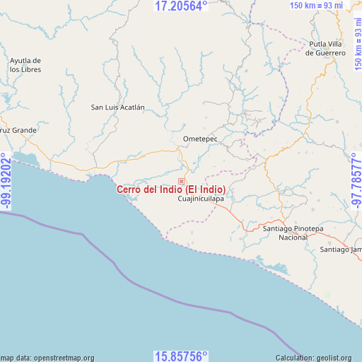
| Upper-left | 17.20564°, | -99.19202° |
| Center: | 16.53278°, | -98.48889° |
| Lower-right: | 15.85756°, | -97.78577° |
| Map W x H: | 149.9×149.9 km | = 93.1×93.1mi |
| max Lat: | 32.7° ⇑94.1% North |
| Cerro del Indio (El Indio): | 16.53278° |
| min Lat: | ⇓5.9% South 14.53588° |
| min Long | Cerro del Indio | max Long |
| -117.105° | -98.48889° | -86.73105° |
| W 57.4%⇐ | ⇒42.6% E |
Elevation
Elevation of Cerro del Indio (El Indio) is 26 m = 85 ft, and this is 1227.7 m = 4028 ft below average elevation for this country.
| Max E: |
3497 m = 11473 ft | 89.4% |
| Avg. | 1253.7 m = 4113 ft | |
| Cerro del Indio (El Indio) | 26 m = 85 ft | |
Min E: |
-1 m = -3 ft | 10.6% |
See also: Mexico elevation on elevation.city.
Geographical zone
Cerro del Indio (El Indio) is located in North Torrid zone (between Equator and Tropic of Cancer). Distance of this Northern Tropic circle is 767.6 km =477 mi to North.| Distance of | km | miles | from Cerro del Indio (El Indio) |
|---|---|---|---|
| North Pole | 8168.8 | 5075.9 | to North |
| Arctic Circle | 5562.9 | 3456.6 | to North |
| Tropic Cancer | 767.6 | 477 | to North |
| Equator | 1838.3 | 1142.3 | to South |


Nearby cities:
15 places around Cerro del Indio (El Indio): (largest is in red/bold)
• Barajillas (Barajilla)
3.8 km =2.4 mi,  135°
135°
• Colonia Miguel Alemán Valdez
4 km =2.5 mi,  273°
273°
• Comaltepec
5.6 km =3.5 mi,  19°
19°
• Cuajinicuilapa
10.4 km =6.5 mi,  129°
129°
• El Pitahayo
4.1 km =2.5 mi, 269°
• El Quiza
9 km =5.6 mi,  97°
97°
• El Terrero
6.2 km =3.9 mi,  58°
58°
• Huehuetán
13.7 km =8.5 mi,  326°
326°
• Maldonado
13.8 km =8.6 mi,  247°
247°
• Milpillas
6.2 km =3.9 mi,  28°
28°
• Piedra Ancha
14.9 km =9.3 mi,  65°
65°
• San Juan Bautista Lo de Soto
15.2 km =9.4 mi, 98°
• San Juan de los Llanos
13.8 km =8.6 mi,  355°
355°
• San Nicolás
13.2 km =8.2 mi,  194°
194°
• Tenango
15.6 km =9.7 mi,  342°
342°
Sources, notices
• [Note1] Compared only with cities in Mexico existing in our database
• [Src1] Map data: © OpenStreetMap contributors (CC-BY-SA)
• [Src2] Other city data from geonames.org with taken over terms of usage.
• [Src3] Geographical zone / Annual Mean Temperature by Robert A. Rohde @ Wikipedia
