Tenango geodata
Tenango (Guerrero) is a populated place; located in Mexico in America/Mexico_City (GMT-6) time zone. With population of 651 people, there are 13306 cities with bigger population in this country. Compared to other cities in Mexico, 93.1% of cities are located further ↑North; 56.8% of cities are located further ←West and 77.1% of cities have higher elevation than Tenango. Note1


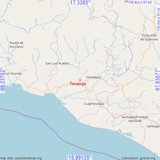
Tenango GPS coordinates[2]
16° 39' 57.996" North, 98° 32' 2.004" West
| Map corner | latitude | longitude |
|---|---|---|
| Upper-left | 17.3385°, | -99.23702° |
| Center: | 16.66611°, | -98.53389° |
| Lower-right: | 15.99135°, | -97.83077° |
| Map W x H: | 149.8×149.8 km | = 93.1×93.1mi |
| max Lat: | 32.7° ⇑93.1% North |
| Tenango: | 16.66611° |
| min Lat: | ⇓6.9% South 14.53588° |
| min Long | Tenango | max Long |
| -117.105° | -98.53389° | -86.73105° |
| W 56.8%⇐ | ⇒43.2% E |
Elevation
Elevation of Tenango is 151 m = 495 ft, and this is 1102.7 m = 3618 ft below average elevation for this country.
| Max E: |
3497 m = 11473 ft | 77.1% |
| Avg. | 1253.7 m = 4113 ft | |
| Tenango | 151 m = 495 ft | |
Min E: |
-1 m = -3 ft | 22.9% |
See also: Mexico elevation on elevation.city.
Geographical zone
Tenango is located in North Torrid zone (between Equator and Tropic of Cancer). Distance of this Northern Tropic circle is 752.8 km =467.8 mi to North.| Distance of | km | miles | from Tenango |
|---|---|---|---|
| North Pole | 8154 | 5066.7 | to North |
| Arctic Circle | 5548.1 | 3447.4 | to North |
| Tropic Cancer | 752.8 | 467.8 | to North |
| Equator | 1853.1 | 1151.5 | to South |


Nearby cities:
15 places around Tenango: (largest is in red/bold)
• Acatepec
13.8 km =8.6 mi,  54°
54°
• Azoyú
10.4 km =6.5 mi,  315°
315°
• Comaltepec
11.6 km =7.2 mi,  144°
144°
• Cruz de Corazón
10.2 km =6.3 mi,  72°
72°
• Huehuetán
4.3 km =2.7 mi,  218°
218°
• Igualapa
10.7 km =6.6 mi,  34°
34°
• Juchitán
12.3 km =7.6 mi,  247°
247°
• Las Vigas
8.4 km =5.2 mi,  81°
81°
• Maxmadi
12.8 km =8 mi,  332°
332°
• Milpillas
12.2 km =7.6 mi, 140°
• Ometepec
13.7 km =8.5 mi, 78°
• Quetzalapa
13.7 km =8.5 mi,  14°
14°
• San Isidro el Puente (El Puente)
10 km =6.2 mi,  262°
262°
• San Juan de los Llanos
3.8 km =2.4 mi,  106°
106°
• Zapotitlán de la Fuente (El Zapote)
11.7 km =7.3 mi,  306°
306°
Sources, notices
• [Note1] Compared only with cities in Mexico existing in our database
• [Src1] Map data: © OpenStreetMap contributors (CC-BY-SA)
• [Src2] Other city data from geonames.org with taken over terms of usage.
• [Src3] Geographical zone / Annual Mean Temperature by Robert A. Rohde @ Wikipedia
