Playa Azul geodata
Playa Azul (Chiapas) is a populated place; located in Mexico in America/Mexico_City (GMT-6) time zone. With population of 606 people, there are 14202 cities with bigger population in this country. Compared to other cities in Mexico, 96.4% of cities are located further ↑North; 96.2% of cities are located further ←West and 62.3% of cities have higher elevation than Playa Azul. Note1


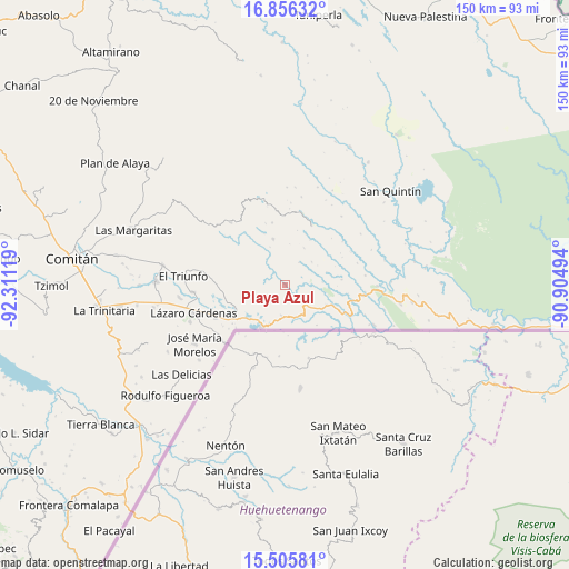
Playa Azul GPS coordinates[2]
16° 10' 55.992" North, 91° 36' 29.016" West
| Map corner | latitude | longitude |
|---|---|---|
| Upper-left | 16.85632°, | -92.31119° |
| Center: | 16.18222°, | -91.60806° |
| Lower-right: | 15.50581°, | -90.90494° |
| Map W x H: | 150.2×150.2 km | = 93.3×93.3mi |
| max Lat: | 32.7° ⇑96.4% North |
| Playa Azul: | 16.18222° |
| min Lat: | ⇓3.6% South 14.53588° |
| min Long | Playa Azul | max Long |
| -117.105° | -91.60806° | -86.73105° |
| W 96.2%⇐ | ⇒3.8% E |
Elevation
Elevation of Playa Azul is 868 m = 2848 ft, and this is 385.7 m = 1265 ft below average elevation for this country.
| Max E: |
3497 m = 11473 ft | 62.3% |
| Avg. | 1253.7 m = 4113 ft | |
| Playa Azul | 868 m = 2848 ft | |
Min E: |
-1 m = -3 ft | 37.7% |
See also: Mexico elevation on elevation.city.
Geographical zone
Playa Azul is located in North Torrid zone (between Equator and Tropic of Cancer). Distance of this Northern Tropic circle is 806.6 km =501.2 mi to North.| Distance of | km | miles | from Playa Azul |
|---|---|---|---|
| North Pole | 8207.8 | 5100.1 | to North |
| Arctic Circle | 5601.9 | 3480.9 | to North |
| Tropic Cancer | 806.6 | 501.2 | to North |
| Equator | 1799.3 | 1118 | to South |


Nearby cities:
15 places around Playa Azul: (largest is in red/bold)
• Amparo Agua Tinta
13.6 km =8.5 mi,  112°
112°
• Cuauhtémoc
8.1 km =5 mi,  187°
187°
• El Edén
12.6 km =7.8 mi,  345°
345°
• El Paraíso
17.7 km =11 mi,  306°
306°
• Ojo de Agua
16.2 km =10.1 mi,  260°
260°
• Río Blanco
3.8 km =2.4 mi, 312°
• San Agustín
6.1 km =3.8 mi,  6°
6°
• San Antonio Buenavista
5.6 km =3.5 mi,  233°
233°
• San Antonio Porvenir
10 km =6.2 mi,  297°
297°
• San Antonio los Montes
11.6 km =7.2 mi,  74°
74°
• San Isidro
16.7 km =10.4 mi, 348°
• San Isidro el Zapotal
2.8 km =1.7 mi, 193°
• Santa Rita el Vergel
15 km =9.3 mi, 302°
• Tierra y Libertad
4.5 km =2.8 mi, 257°
• Tziscao
12.8 km =8 mi,  209°
209°
Sources, notices
• [Note1] Compared only with cities in Mexico existing in our database
• [Src1] Map data: © OpenStreetMap contributors (CC-BY-SA)
• [Src2] Other city data from geonames.org with taken over terms of usage.
• [Src3] Geographical zone / Annual Mean Temperature by Robert A. Rohde @ Wikipedia
