Tziscao geodata
Tziscao (Chiapas) is a populated place; located in Mexico in America/Mexico_City (GMT-6) time zone. With population of 1,562 people, there are 5526 cities with bigger population in this country. Compared to other cities in Mexico, 97% of cities are located further ↑North; 96% of cities are located further ←West and 51.5% of cities have lower elevation than Tziscao. Note1


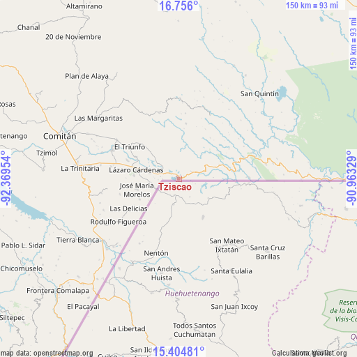
Tziscao GPS coordinates[2]
16° 4' 53.58" North, 91° 39' 59.076" West
| Map corner | latitude | longitude |
|---|---|---|
| Upper-left | 16.756°, | -92.36954° |
| Center: | 16.08155°, | -91.66641° |
| Lower-right: | 15.40481°, | -90.96329° |
| Map W x H: | 150.2×150.2 km | = 93.3×93.3mi |
| max Lat: | 32.7° ⇑97% North |
| Tziscao: | 16.08155° |
| min Lat: | ⇓3% South 14.53588° |
| min Long | Tziscao | max Long |
| -117.105° | -91.66641° | -86.73105° |
| W 96%⇐ | ⇒4% E |
Elevation
Elevation of Tziscao is 1505 m = 4938 ft, and this is 251.3 m = 824 ft above average elevation for this country.
| Max E: |
3497 m = 11473 ft | 48.5% |
| Tziscao | 1505 m 4938 ft | |
| Avg. | 1253.7 m = 4113 ft | |
Min E: |
-1 m = -3 ft | 51.5% |
See also: Mexico elevation on elevation.city.
Geographical zone
Tziscao is located in North Torrid zone (between Equator and Tropic of Cancer). Distance of this Northern Tropic circle is 817.8 km =508.2 mi to North.| Distance of | km | miles | from Tziscao |
|---|---|---|---|
| North Pole | 8219 | 5107 | to North |
| Arctic Circle | 5613.1 | 3487.8 | to North |
| Tropic Cancer | 817.8 | 508.2 | to North |
| Equator | 1788.1 | 1111.1 | to South |


Nearby cities:
15 places around Tziscao: (largest is in red/bold)
• Carmen Xhán
10.4 km =6.5 mi,  246°
246°
• Cuauhtémoc
6.1 km =3.8 mi,  58°
58°
• José María Morelos
18.2 km =11.3 mi,  256°
256°
• Lázaro Cárdenas
18.3 km =11.4 mi,  282°
282°
• Miguel Hidalgo
12.2 km =7.6 mi, 281°
• Ojo de Agua
12.9 km =8 mi,  310°
310°
• Playa Azul
12.8 km =8 mi,  29°
29°
• Río Blanco
14.1 km =8.8 mi,  14°
14°
• San Agustín
18.5 km =11.5 mi,  21°
21°
• San Antonio Buenavista
8.1 km =5 mi, 12°
• San Antonio Porvenir
16 km =9.9 mi,  350°
350°
• San Isidro el Zapotal
10.1 km =6.3 mi, 33°
• Tierra y Libertad
10.4 km =6.5 mi, 10°
• Vicente Guerrero
18.6 km =11.6 mi,  242°
242°
• Álvaro Obregón
18.9 km =11.7 mi,  274°
274°
Sources, notices
• [Note1] Compared only with cities in Mexico existing in our database
• [Src1] Map data: © OpenStreetMap contributors (CC-BY-SA)
• [Src2] Other city data from geonames.org with taken over terms of usage.
• [Src3] Geographical zone / Annual Mean Temperature by Robert A. Rohde @ Wikipedia
