Yalentay (San Joaquín) geodata
Yalentay (San Joaquín) (Chiapas) is a populated place; located in Mexico in America/Mexico_City (GMT-6) time zone. With population of 597 people, there are 14400 cities with bigger population in this country. Compared to other cities in Mexico, 92.5% of cities are located further ↑North; 90.1% of cities are located further ←West and 92.2% of cities have lower elevation than Yalentay (San Joaquín). Note1
Current local time in Yalentay (San Joaquín):
05:28 AM, WednesdayDifference from your time zone: hours


Yalentay (San Joaquín) GPS coordinates[2]
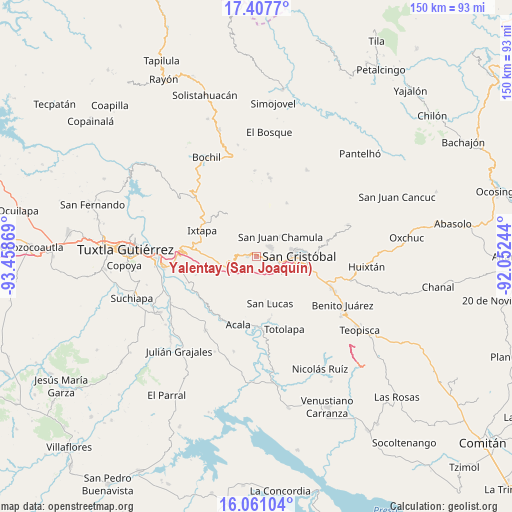
16° 44' 8.016" North, 92° 45' 20.016" West
| Map corner | latitude | longitude |
|---|---|---|
| Upper-left | 17.4077°, | -93.45869° |
| Center: | 16.73556°, | -92.75556° |
| Lower-right: | 16.06104°, | -92.05244° |
| Map W x H: | 149.7×149.7 km | = 93×93mi |
| max Lat: | 32.7° ⇑92.5% North |
| Yalentay (San Joaquín): | 16.73556° |
| min Lat: | ⇓7.5% South 14.53588° |
| min Long | Yalentay (San J | max Long |
| -117.105° | -92.75556° | -86.73105° |
| W 90.1%⇐ | ⇒9.9% E |
Elevation
Elevation of Yalentay (San Joaquín) is 2494 m = 8182 ft, and this is 1240.3 m = 4069 ft above average elevation for this country.
| Max E: |
3497 m = 11473 ft | 7.8% |
| Yalentay (San Joaquín) | 2494 m 8182 ft | |
| Avg. | 1253.7 m = 4113 ft | |
Min E: |
-1 m = -3 ft | 92.2% |
See also: Mexico elevation on elevation.city.
Geographical zone
Yalentay (San Joaquín) is located in North Torrid zone (between Equator and Tropic of Cancer). Distance of this Northern Tropic circle is 745.1 km =463 mi to North.| Distance of | km | miles | from Yalentay (San Joaquín) |
|---|---|---|---|
| North Pole | 8146.2 | 5061.8 | to North |
| Arctic Circle | 5540.4 | 3442.6 | to North |
| Tropic Cancer | 745.1 | 463 | to North |
| Equator | 1860.8 | 1156.2 | to South |


Nearby cities:
15 places around Yalentay (San Joaquín): (largest is in red/bold)
• Apas
4.9 km =3 mi,  235°
235°
• Arvenza Uno
6.2 km =3.9 mi,  37°
37°
• Bahosil
5.7 km =3.5 mi,  31°
31°
• Bochojbo Alto
4.1 km =2.5 mi,  89°
89°
• Catishtic
5.3 km =3.3 mi,  20°
20°
• El Pig
1.1 km =0.7 mi,  246°
246°
• Jech Chentic
2 km =1.2 mi,  107°
107°
• Jechtoch
4.1 km =2.5 mi, 106°
• Nachig
3.3 km =2.1 mi,  99°
99°
• Navenchauc
2.5 km =1.6 mi,  268°
268°
• Pasté
3.8 km =2.4 mi,  156°
156°
• Patosil
2.4 km =1.5 mi, 39°
• Shulvo
2.8 km =1.7 mi,  122°
122°
• Ukumtic
6.7 km =4.2 mi, 23°
• Zinacantán
4.5 km =2.8 mi,  52°
52°
Sources, notices
• [Note1] Compared only with cities in Mexico existing in our database
• [Src1] Map data: © OpenStreetMap contributors (CC-BY-SA)
• [Src2] Other city data from geonames.org with taken over terms of usage.
• [Src3] Geographical zone / Annual Mean Temperature by Robert A. Rohde @ Wikipedia
