Popoyatlajco geodata
Popoyatlajco (Guerrero) is a populated place; located in Mexico in America/Mexico_City (GMT-6) time zone. With population of 592 people, there are 14508 cities with bigger population in this country. Compared to other cities in Mexico, 83.1% of cities are located further ↑North; 53.9% of cities are located further →East and 60.8% of cities have lower elevation than Popoyatlajco. Note1


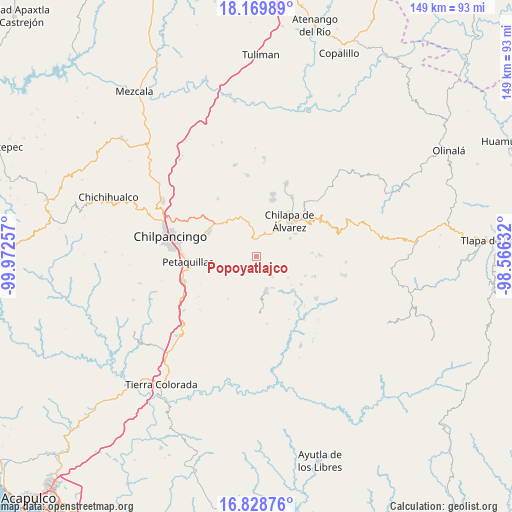
Popoyatlajco GPS coordinates[2]
17° 30' 2.016" North, 99° 16' 9.984" West
| Map corner | latitude | longitude |
|---|---|---|
| Upper-left | 18.16989°, | -99.97257° |
| Center: | 17.50056°, | -99.26944° |
| Lower-right: | 16.82876°, | -98.56632° |
| Map W x H: | 149.1×149.1 km | = 92.6×92.6mi |
| max Lat: | 32.7° ⇑83.1% North |
| Popoyatlajco: | 17.50056° |
| min Lat: | ⇓16.9% South 14.53588° |
| min Long | Popoyatlajco | max Long |
| -117.105° | -99.26944° | -86.73105° |
| W 46.1%⇐ | ⇒53.9% E |
Elevation
Elevation of Popoyatlajco is 1741 m = 5712 ft, and this is 487.3 m = 1599 ft above average elevation for this country.
| Max E: |
3497 m = 11473 ft | 39.2% |
| Popoyatlajco | 1741 m 5712 ft | |
| Avg. | 1253.7 m = 4113 ft | |
Min E: |
-1 m = -3 ft | 60.8% |
See also: Mexico elevation on elevation.city.
Geographical zone
Popoyatlajco is located in North Torrid zone (between Equator and Tropic of Cancer). Distance of this Northern Tropic circle is 660 km =410.1 mi to North.| Distance of | km | miles | from Popoyatlajco |
|---|---|---|---|
| North Pole | 8061.2 | 5009 | to North |
| Arctic Circle | 5455.3 | 3389.8 | to North |
| Tropic Cancer | 660 | 410.1 | to North |
| Equator | 1945.9 | 1209.1 | to South |


Nearby cities:
15 places around Popoyatlajco: (largest is in red/bold)
• Achigca
4.6 km =2.9 mi,  128°
128°
• Acuentla
3 km =1.9 mi,  47°
47°
• Ahuexotitlán
4.1 km =2.5 mi,  41°
41°
• Axopilco
7.7 km =4.8 mi,  67°
67°
• Chilacachapa
6.3 km =3.9 mi,  351°
351°
• Coatomatitlán
6.6 km =4.1 mi,  241°
241°
• Cuonetzingo
3 km =1.9 mi,  7°
7°
• El Durazno
3.8 km =2.4 mi,  323°
323°
• Monte Alegre
2.8 km =1.7 mi,  261°
261°
• Ostocapa
7.7 km =4.8 mi,  140°
140°
• San Martín
4.9 km =3 mi,  212°
212°
• San Miguel
5.3 km =3.3 mi,  220°
220°
• Tlamixtlahuacan
4.6 km =2.9 mi,  86°
86°
• Tonalapa
3.1 km =1.9 mi,  110°
110°
• Zoquiapa
5 km =3.1 mi, 350°
Sources, notices
• [Note1] Compared only with cities in Mexico existing in our database
• [Src1] Map data: © OpenStreetMap contributors (CC-BY-SA)
• [Src2] Other city data from geonames.org with taken over terms of usage.
• [Src3] Geographical zone / Annual Mean Temperature by Robert A. Rohde @ Wikipedia
