El Durazno geodata
El Durazno (Guerrero) is a populated place; located in Mexico in America/Mexico_City (GMT-6) time zone. With population of 1,170 people, there are 7425 cities with bigger population in this country. Compared to other cities in Mexico, 82.9% of cities are located further ↑North; 54.1% of cities are located further →East and 69.6% of cities have lower elevation than El Durazno. Note1


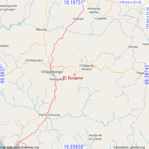
El Durazno GPS coordinates[2]
17° 31' 41.808" North, 99° 17' 26.052" West
| Map corner | latitude | longitude |
|---|---|---|
| Upper-left | 18.19751°, | -99.9937° |
| Center: | 17.52828°, | -99.29057° |
| Lower-right: | 16.85658°, | -98.58745° |
| Map W x H: | 149.1×149.1 km | = 92.6×92.6mi |
| max Lat: | 32.7° ⇑82.9% North |
| El Durazno: | 17.52828° |
| min Lat: | ⇓17.1% South 14.53588° |
| min Long | El Durazno | max Long |
| -117.105° | -99.29057° | -86.73105° |
| W 45.9%⇐ | ⇒54.1% E |
Elevation
Elevation of El Durazno is 1917 m = 6289 ft, and this is 663.3 m = 2176 ft above average elevation for this country.
| Max E: |
3497 m = 11473 ft | 30.4% |
| El Durazno | 1917 m 6289 ft | |
| Avg. | 1253.7 m = 4113 ft | |
Min E: |
-1 m = -3 ft | 69.6% |
See also: Mexico elevation on elevation.city.
Geographical zone
El Durazno is located in North Torrid zone (between Equator and Tropic of Cancer). Distance of this Northern Tropic circle is 657 km =408.2 mi to North.| Distance of | km | miles | from El Durazno |
|---|---|---|---|
| North Pole | 8058.1 | 5007.1 | to North |
| Arctic Circle | 5452.2 | 3387.8 | to North |
| Tropic Cancer | 657 | 408.2 | to North |
| Equator | 1949 | 1211.1 | to South |


Nearby cities:
15 places around El Durazno: (largest is in red/bold)
• Achigca
8.4 km =5.2 mi,  135°
135°
• Acuentla
4.5 km =2.8 mi,  103°
103°
• Ahuexotitlán
4.9 km =3 mi,  89°
89°
• Chilacachapa
3.4 km =2.1 mi,  22°
22°
• Coaquimixco
8.1 km =5 mi,  45°
45°
• Coatomatitlán
7.2 km =4.5 mi,  209°
209°
• Cuonetzingo
2.6 km =1.6 mi, 92°
• Monte Alegre
3.5 km =2.2 mi,  188°
188°
• Popoyatlajco
3.8 km =2.4 mi, 143°
• San Martín
7.3 km =4.5 mi,  183°
183°
• San Miguel
7.2 km =4.5 mi, 189°
• Tlamixtlahuacan
7.4 km =4.6 mi,  112°
112°
• Tonalapa
6.6 km =4.1 mi,  129°
129°
• Zacatzonapa
6.3 km =3.9 mi,  242°
242°
• Zoquiapa
2.3 km =1.4 mi,  38°
38°
Sources, notices
• [Note1] Compared only with cities in Mexico existing in our database
• [Src1] Map data: © OpenStreetMap contributors (CC-BY-SA)
• [Src2] Other city data from geonames.org with taken over terms of usage.
• [Src3] Geographical zone / Annual Mean Temperature by Robert A. Rohde @ Wikipedia
