El Barí 1ra. Sección geodata
El Barí 1ra. Sección (Tabasco) is a populated place; located in Mexico in America/Mexico_City (GMT-6) time zone. With population of 574 people, there are 14926 cities with bigger population in this country. Compared to other cities in Mexico, 76.1% of cities are located further ↑North; 85.8% of cities are located further ←West and 94.6% of cities have higher elevation than El Barí 1ra. Sección. Note1
Current local time in El Barí 1ra. Sección:
05:20 AM, WednesdayDifference from your time zone: hours


El Barí 1ra. Sección GPS coordinates[2]
18° 12' 41.004" North, 94° 4' 51.996" West
| Map corner | latitude | longitude |
|---|---|---|
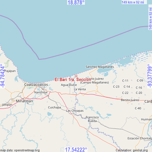
| Upper-left | 18.878°, | -94.78424° |
| Center: | 18.21139°, | -94.08111° |
| Lower-right: | 17.54222°, | -93.37799° |
| Map W x H: | 148.5×148.5 km | = 92.3×92.3mi |
| max Lat: | 32.7° ⇑76.1% North |
| El Barí 1ra. Sección: | 18.21139° |
| min Lat: | ⇓23.9% South 14.53588° |
| min Long | El Barí 1ra. S | max Long |
| -117.105° | -94.08111° | -86.73105° |
| W 85.8%⇐ | ⇒14.2% E |
Elevation
Elevation of El Barí 1ra. Sección is 14 m = 46 ft, and this is 1239.7 m = 4067 ft below average elevation for this country.
| Max E: |
3497 m = 11473 ft | 94.6% |
| Avg. | 1253.7 m = 4113 ft | |
| El Barí 1ra. Sección | 14 m = 46 ft | |
Min E: |
-1 m = -3 ft | 5.4% |
See also: Mexico elevation on elevation.city.
Geographical zone
El Barí 1ra. Sección is located in North Torrid zone (between Equator and Tropic of Cancer). Distance of this Northern Tropic circle is 581 km =361 mi to North.| Distance of | km | miles | from El Barí 1ra. Sección |
|---|---|---|---|
| North Pole | 7982.1 | 4959.8 | to North |
| Arctic Circle | 5376.3 | 3340.7 | to North |
| Tropic Cancer | 581 | 361 | to North |
| Equator | 2024.9 | 1258.2 | to South |


Nearby cities:
15 places around El Barí 1ra. Sección: (largest is in red/bold)
• Agua Dulce
10.5 km =6.5 mi,  220°
220°
• Benito Juárez 1ra. Sección
25.8 km =16 mi,  124°
124°
• Blasillo 1ra. Sección (Nicolás Bravo)
22.7 km =14.1 mi,  130°
130°
• Blasillo 2da. Sección (Otates)
21.9 km =13.6 mi,  137°
137°
• Colorado
26.2 km =16.3 mi,  256°
256°
• Cuauhtemoczin
4.8 km =3 mi, 259°
• El Encanto
24.6 km =15.3 mi,  189°
189°
• El Yucateco
6.7 km =4.2 mi,  88°
88°
• Guillermo Prieto
21.4 km =13.3 mi,  254°
254°
• La Vencedora
31.2 km =19.4 mi, 125°
• Los Manantiales
16.4 km =10.2 mi, 190°
• Nuevo Teapa
29.6 km =18.4 mi,  238°
238°
• Pejelagartero 1ra. Sección (Plataforma)
32.2 km =20 mi, 122°
• Tonalá
6.4 km =4 mi,  265°
265°
• Villa la Venta
13.1 km =8.1 mi,  163°
163°
Sources, notices
• [Note1] Compared only with cities in Mexico existing in our database
• [Src1] Map data: © OpenStreetMap contributors (CC-BY-SA)
• [Src2] Other city data from geonames.org with taken over terms of usage.
• [Src3] Geographical zone / Annual Mean Temperature by Robert A. Rohde @ Wikipedia
