Villa la Venta geodata
Villa la Venta (Tabasco) is a populated place; located in Mexico in America/Mexico_City (GMT-6) time zone. With population of 8,821 people, there are 1076 cities with bigger population in this country. Compared to other cities in Mexico, 77.6% of cities are located further ↑North; 85.8% of cities are located further ←West and 91.6% of cities have higher elevation than Villa la Venta. Note1


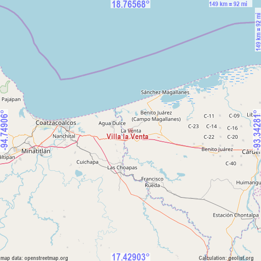
Villa la Venta GPS coordinates[2]
18° 5' 55.068" North, 94° 2' 45.348" West
| Map corner | latitude | longitude |
|---|---|---|
| Upper-left | 18.76568°, | -94.74906° |
| Center: | 18.09863°, | -94.04593° |
| Lower-right: | 17.42903°, | -93.34281° |
| Map W x H: | 148.6×148.6 km | = 92.3×92.3mi |
| max Lat: | 32.7° ⇑77.6% North |
| Villa la Venta: | 18.09863° |
| min Lat: | ⇓22.4% South 14.53588° |
| min Long | Villa la Venta | max Long |
| -117.105° | -94.04593° | -86.73105° |
| W 85.8%⇐ | ⇒14.2% E |
Elevation
Elevation of Villa la Venta is 20 m = 66 ft, and this is 1233.7 m = 4048 ft below average elevation for this country.
| Max E: |
3497 m = 11473 ft | 91.6% |
| Avg. | 1253.7 m = 4113 ft | |
| Villa la Venta | 20 m = 66 ft | |
Min E: |
-1 m = -3 ft | 8.4% |
See also: Mexico elevation on elevation.city.
Geographical zone
Villa la Venta is located in North Torrid zone (between Equator and Tropic of Cancer). Distance of this Northern Tropic circle is 593.5 km =368.8 mi to North.| Distance of | km | miles | from Villa la Venta |
|---|---|---|---|
| North Pole | 7994.7 | 4967.7 | to North |
| Arctic Circle | 5388.8 | 3348.4 | to North |
| Tropic Cancer | 593.5 | 368.8 | to North |
| Equator | 2012.4 | 1250.4 | to South |


Nearby cities:
15 places around Villa la Venta: (largest is in red/bold)
• Agua Dulce
11.4 km =7.1 mi,  293°
293°
• Benito Juárez 1ra. Sección
17.8 km =11.1 mi,  96°
96°
• Blasillo 1ra. Sección (Nicolás Bravo)
13.7 km =8.5 mi, 99°
• Blasillo 2da. Sección (Otates)
11.6 km =7.2 mi,  108°
108°
• Cuauhtemoczin
14.5 km =9 mi,  324°
324°
• El Barí 1ra. Sección
13.1 km =8.1 mi,  343°
343°
• El Encanto
14.1 km =8.8 mi,  214°
214°
• El Yucateco
13 km =8.1 mi,  13°
13°
• Guillermo Prieto
25.3 km =15.7 mi, 285°
• La Vencedora
22.4 km =13.9 mi, 103°
• Las Choapas
21.5 km =13.4 mi,  194°
194°
• Los Manantiales
7.6 km =4.7 mi,  241°
241°
• Pejelagartero 1ra. Sección (Plataforma)
23.9 km =14.9 mi, 101°
• San José del Carmen
25.8 km =16 mi, 189°
• Tonalá
15.7 km =9.8 mi, 320°
Sources, notices
• [Note1] Compared only with cities in Mexico existing in our database
• [Src1] Map data: © OpenStreetMap contributors (CC-BY-SA)
• [Src2] Other city data from geonames.org with taken over terms of usage.
• [Src3] Geographical zone / Annual Mean Temperature by Robert A. Rohde @ Wikipedia
